
 September 10, 2026
Central Valley groundwater has been drawn down faster than it’s been replenished for decades. Water tables have dropped, the ground has sunk significantly in places, and expensive infrastructure like roads and bridges has suffered damage. California’s Sustainable Groundwater Management Act (SGMA), a 2014 state law requiring local water managers to bring over-drafted groundwater basins back into balance by the early 2040s, sets out to fix that. Doing so means more water needs to go into the ground than comes out of it. River Partners has long known its statewide restoration work supports that goal. A new body of research now refines that picture, showing with much more precision how much groundwater our projects recharge, and where.
A unique partnership with Lawrence Livermore National Laboratory (LLNL), Stanford University, and Stanislaus State took that on. From December 2023 to March 2026, researchers studied five River Partners restoration projects clustered around the 1,600-acre Dos Rios State Park near Modesto, the largest floodplain reconnection project in state history that River Partners completed in 2022, plus two future project sites in Merced County. The results confirm what River Partners has long understood: restored floodplains recharge the aquifer beneath them, not just bring back habitat above it. Now the data are revealing, site by site and with far more precision, where that recharge is strongest and where it isn’t.
“We can’t do this on our own,” said River Partners Senior Scientist Dr. Sarah Gaffney. “This is high-tech research and modeling. Each of our partners specializes in a different part of the groundwater world, and we could not have gotten this large takeaway or understanding of what’s truly going on if we only worked with one of them.”
Two findings from our joint research matter most. The first confirms that areas River Partners has previously restored are already recharging groundwater. The second shows how precisely recharge can now be mapped, site by site—giving us a powerful new tool to target restoration where it can deliver the greatest groundwater benefits.
Restored Land is Already Recharging the Aquifer
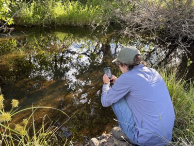
LLNL researcher Dr. Ate Visser specializes in isotope analysis, which measures the ratios of different isotopes—atoms of the same element with varying numbers of neutrons—within a sample to reveal information about its origin or history. Visser and his team used this method at Dos Rios State Park and River Partners’ 350-acre Hidden Valley Ranch to trace water in the soil and inside the tissue of cottonwood and oak trees back to the nearby San Joaquin River months after irrigation had stopped. Every sample his team analyzed came back holding more than 50% river-derived water, a result of decades of crop irrigation with river water before the land was restored to floodplains. The team expects that in the future, natural flooding of the floodplain will continue to recharge the groundwater system. This direct, physical evidence confirms the groundwater benefits of restored riverways, and sharpens them into specific, measurable numbers.
“It was surprising to see that at first, but then we learned about the agricultural history of the area and the farming practices,” said Visser. “The area had been farmed with irrigation from river water for decades, and water was pumped up from the rivers into basins and then spread out over the fields.”
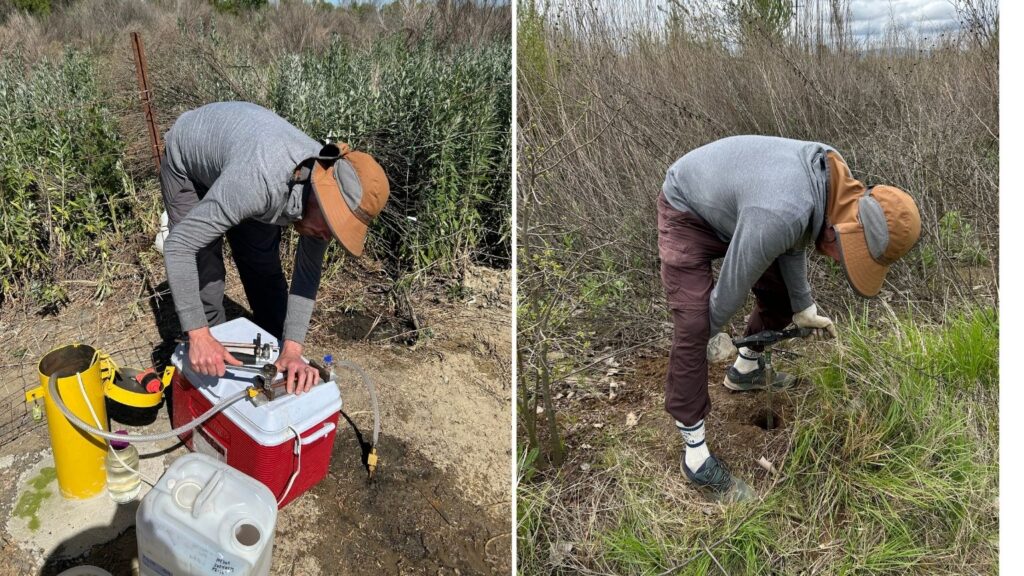
That matters directly for SGMA. Dr. Rosemary Knight of Stanford, whose team mapped the subsurfaces at our 285-acre Grayson Riverbend Preserve, Hidden Valley Ranch, and 168-acre Ott Farms using towed time-domain electromagnetic imaging (tTEM), essentially an MRI of the ground, points to what she calls the “six deadly sins” of groundwater pumping that SGMA targets, including falling water levels and land subsidence.
“Water-out is exceeding water-in, and the water-in is recharge. Anything we can do to increase recharge moves us toward stabilizing groundwater levels,” she said. “Whether you recharge basins on agricultural lands or on floodplains, all recharge is good and is stopping the downward drop of water levels.”
Recharge Potential Isn’t the Same
This finding will shape how River Partners plans its future restoration and recharge projects, and it’s a good example of how much sharper the science keeps getting. Knight’s team found that recharge suitability shifted dramatically over short distances at Bear Creek Ranch near Merced, a future River Partners restoration included in the study. Regional maps built from aerial surveys label an entire property “suitable” or “not suitable” for recharge. Up close, with the fine-grained data, that picture gets a lot more precise.
“When you get in there and acquire detailed geophysical data, as we did with River Partners at the scale of individual floodplains, you realize that when looking at a big picture, it all looks the same,” Knight said. “But when you get in close and look at what’s there with better spatial resolution, you can see how variable the subsurface is.”
The reason? Buried beneath every site are ancient river channels, filled with different mixtures of sand, gravel, and clay, that can change character within roughly 30 feet.

That variability matters in how we design our sites, not just for the research. Sandy, fast-draining ground supports strong recharge. Clay-heavy ground holds water at the surface instead, forming the seasonal ponds migratory birds rely on along the 10,000-mile Pacific Flyway that cuts through California’s Central Valley, and a significant number of landscapes River Partners has restored or has its sights set on.
“We suddenly went, wait a minute,” Knight said. “This is good for recharge, and it’s good for wildlife.”
The same floodplain can support both—the kind of multi-benefit design the state’s recharge programs encourage. For River Partners, that means bringing the fine-grained subsurface mapping this study used at Dos Rios into restoration design earlier on projects that have groundwater recharge as a goal.
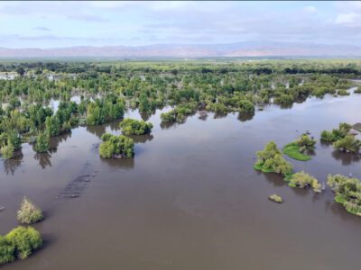
The historic flooding along the San Joaquin River in 2023 showed what that looks like at scale. Our projects are managed to let floodwater move onto and stay on the land rather than move it off quickly, which gives that water more time to soak in. River Partners’ 285-acre Grayson Riverbend Preserve west of Modesto, now part of the San Joaquin River National Wildlife Refuge, and Dos Rios State Park stayed underwater for five straight months, as water worked its way into the ground instead of running off.
That kind of resolution was only possible because the Dos Rios Complex isn’t one project—it’s a cluster of them sitting next to each other, totaling over 10,000 acres.
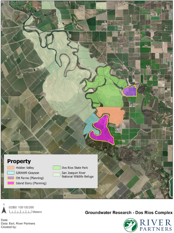
“Because we have a series of projects of different ages and planning stages all connected there, we were able to learn more about recharge than we would have by looking at just one property or project,” said River Partners Director of Restoration Science Emma Havstad. “Water movement is not limited by property boundary lines drawn on a map, unless those lines correspond to levees or irrigation lines, so there was a lot of value in that.”
The Next Step: Capturing Data from an Actual Flood
“Groundwater is money in the bank,” said Dr. Horacio Ferriz, of the Department of Geology at Stanislaus State. “If you use it, you create the space. And in the next rain or the next flood, you’ll be able to fill in the space.”
The problem is that nobody has been tracking the balance closely. Ferriz spent months trying to verify recharge against existing groundwater well data across the region and found the record thin.
“There aren’t that many wells that are being measured,” he said. “It’s a very spotty database.”
The study’s biggest gap is timing. There wasn’t major flooding during the research window, so researchers could measure legacy recharge from decades of irrigation but not recharge from an active flood event. River Partners is now pursuing funding to station monitoring equipment ahead of the next one. Forecasters expect the 2027 water year to bring historic El Niño conditions, which in the Central Valley usually means a flood year. Capturing data during an actual flood would fill the last major gap in what this partnership has learned so far.
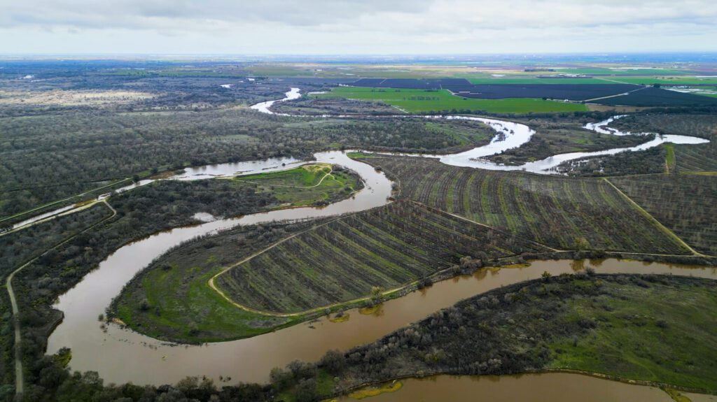
Gaffney is already looking at the next question this research opens up: whether the water recharging beneath these floodplains eventually finds its way back into the river, benefiting the Central Valley salmon that depend on it.
The report is the latest chapter in River Partners’ understanding of Central Valley groundwater, not the final one. It gives River Partners a more precise set of tools—tTEM mapping, isotope tracing, site-specific recharge modeling—to keep refining how much water its restoration projects put back into the ground and to bring into the design of future projects where recharge matters.
“I hope this research can provide an even better framework for River Partners to utilize and explore whether a site would be useful for that goal,” Gaffney said. “This report can be a stepping stone for us to understand what other questions we want to ask.”
Lead photo courtesy of Becca Prentice / Stanford University