
 August 4, 2026
Chris Carrizales was born and raised in Hamilton City, a Northern California town of about 2,200 along the Sacramento River, the state’s largest waterway. The town also sits within a historic floodplain, and an aging levee built in 1906, weakened by flooding, erosion, and time, became unreliable in keeping Hamilton City safe. Seasonal rains turned into flooding, which has forced evacuations six times since the 1980s (1983, 1986, twice in 1995, 1997, and 1998).
“This community is resilient, cooperative, and we work together to make sure we’re all safe,” Carrizales said. “But there’s always the nagging feeling that this will be the one that does something Hamilton City won’t be able to bounce back from.”
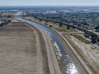
Carrizales, a Field Foreman at River Partners, helped lead the habitat restoration portion of the Hamilton City project. In 2016, during Phase 1, River Partners planted riparian forest, scrub, oak savanna, and grassland habitats while the United States Army Corps of Engineers (USACE) built a 6.8-mile setback levee, completed in 2017; planting wrapped up in 2019.
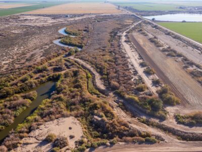
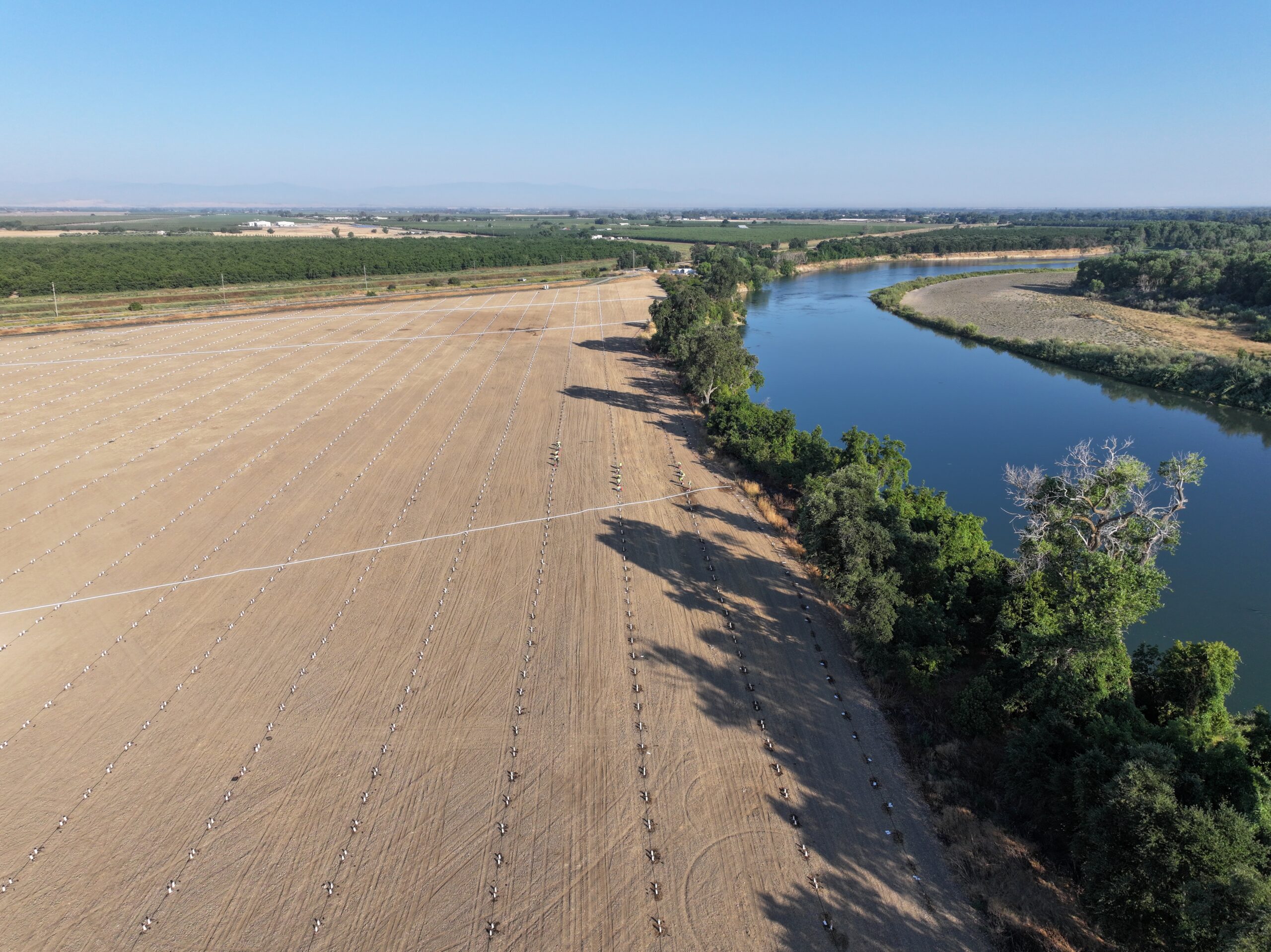
In Phase 2, in 2024, nearly 465 acres of former farmland were transformed back to native habitat with 67,000 native trees and plants, creating space for water to flow and pool when the Sacramento River overflows. That water can seep into the ground instead of rushing into town, recharging aquifers, and giving juvenile salmon a place to rest and feed before returning to the river. That kind of flooding is exactly what the state has been trying to encourage. Governor Newsom signed an executive order in 2023 making it easier for water agencies to divert flood-stage water for groundwater recharge, part of a broader push to bank more floodwater underground for the dry times ahead.
A Model Taking Root
Together, this project has increased flood safety for Hamilton City residents.
For decades, Hamilton City’s future was uncertain because repeated flooding and a deteriorating levee system threatened the community, while traditional federal cost-benefit analyses concluded that the expense of modern flood protection could not be economically justified for a town of its size and property values. Only when flood protection was combined with large-scale floodplain and riparian habitat restoration did the project become economically viable for federal investment. Today, it remains a funding model used for multi-benefit flood and habitat projects statewide and nationally.
The approach lines up with the state’s own strategy. California’s Central Valley Flood Protection Plan calls for exactly this kind of setback levee paired with floodplain restoration to cut flood risk across the region. Hamilton City isn’t an outlier; it’s the model state planners want to see more of. And the payoff shows up in numbers federal disaster agencies track closely — fewer damaged homes, fewer evacuations, less strain on emergency crews the next time the river rises.
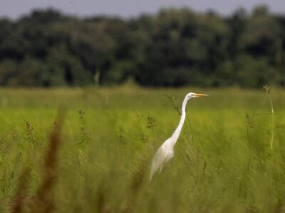
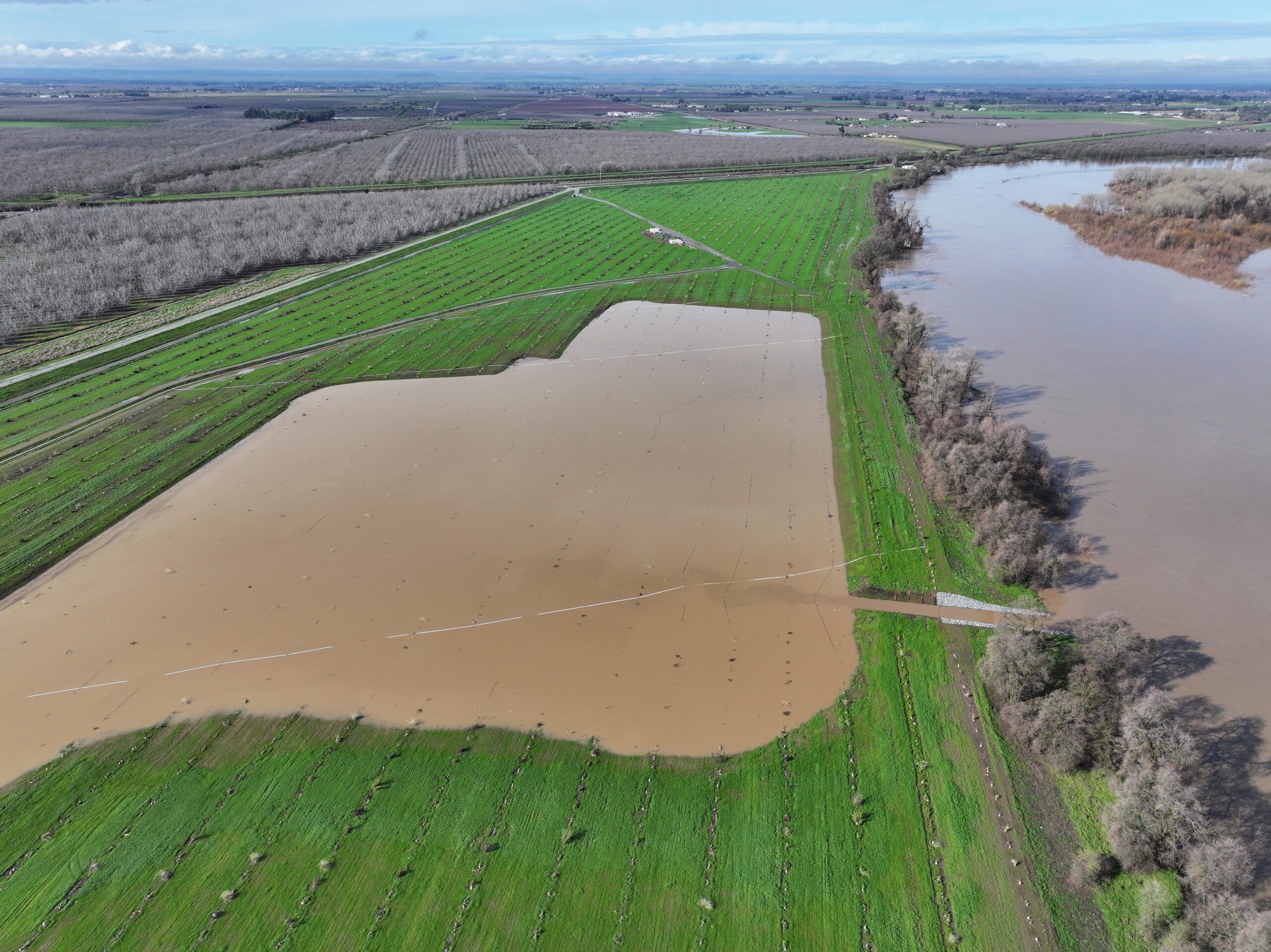
Two years after restoration, native trees and plants have taken root, with some sycamores over 15 feet tall. Deer, beavers, turkey, and quail use the site heavily for food, shelter, and nesting. Along with the setback levee, the restored floodplain has already redirected floodwater away from town several times since completion, recharging aquifers and feeding imperiled juvenile salmon each time.
“There’s a pool area in the northern field, it’s a larger indentation meant to hold some of the overflow from the river when it gets too high,” said River Partners Field Manager Kyler Stassi. “The purpose of that is to offset some of the flooding hazard to Hamilton City, but a byproduct of that ends up being some of that phytoplankton bloom produced from having the standing water sit for a time over native vegetation. As that vegetation starts to biodegrade, it creates food for phytoplankton to bloom, which then provides nutrients back into the river system for fish to feed on.”
The floodplains have also proven they can hold water from both rain and river overflow, and that may be tested further this fall and winter, with growing signs that California could see a significant El Niño, possibly one of the strongest in the last century.
“The bigger picture here was flood safety for Hamilton City during increased flow events,” Stassi said. “The landscape tells a story, and I’m eager to see what happens here.”
The El Niño Stress Test
Hamilton City spans less than a third of a square mile, and its historically underrepresented community depends heavily on agriculture. Its century-old levee had severely degraded, and as the community grew and agriculture expanded through the 20th century, groundwater was depleted and filled with chemical runoff, harming local wildlife from songbirds to salmon. The town is also officially designated a disadvantaged community by the state — one that state agencies are paying closer attention to when they decide where flood and water infrastructure dollars go.
With El Niño looming, the restoration offers more assurance if the community needs to evacuate.
“It’s meant to reduce the risk of flooding, provide more protection, and afford more time for the community and local officials in case they need to react to a flood that’s coming down the system,” said Ryan Luster, an ecologist for The Nature Conservancy (TNC) and lead on the Hamilton City project.
The project also protects the two-lane highway that serves as the main route in and out of town and a critical emergency access road between the west and east sides of the Northern Sacramento Valley. That matters even more for medical emergencies, Luster said, since the Glenn Medical Center in Willows closed last year. From Hamilton High School, that facility was about 26 miles away; the next closest is now nearly 40.
“Keeping the road open was not a primary goal of the project, it was more of a secondary goal,” Luster said. “But it’s a super important secondary goal, and it’s become even more important because there are now fewer emergency facilities on the west side of the Sacramento River.”
Project anniversaries offer a chance to see how sites mature, Luster said, and Hamilton City is no different, especially under a potential stress test.
“It’ll be interesting to see how the vegetation responds to flooding, if water will sit on the newly restored area for long periods of time, and what that does to the vegetation,” he said. “From a technical perspective, it could be interesting to see how the system and design perform under a potential stress test. Time will tell.”
From Flood Liability to Floodplain
Before restoration, the project site was farmland for over 100 years, made up of many parcels. One, a walnut orchard, belonged to Gunnhill Farms LLC, founded by Gunnar and Hilli Sevelius. Their daughter, Pia, was working for Glenn County when a co-worker suggested she look into buying a walnut orchard along the Sacramento River.
“He said these orchards were a tremendous asset, and it was a good opportunity to invest in orchards,” said Sevelius, who also serves on River Partners’ Board of Directors, “but they happened to be in an economic slump.”
Sevelius told her parents, who traveled to see the site.
“My parents weren’t farmers,” she said. “All they saw was this beautiful piece of land on the river.”
They fell for the site, charmed that it sat on the Jenny Lind Bend, named for the 18th-century Swedish opera singer.
“My parents were Swedish, so they said, ‘It’s meant to be!’” she said.
The family bought the property in 1980 and soon learned why the orchard was struggling financially.
“The previous owner farmed it for us for several years, and then it flooded—suddenly it wasn’t so meant to be,” Sevelius said.
After years of losing money and land to erosion following El Niño storms in the late 1990s, the family approached TNC about purchasing the property once California passed Senate Bill 1086, clearing the way for the Hamilton City project. TNC bought the land from Gunnhill Farms in 2000, then owned and managed it before donating it to the local Reclamation District, while also designing the restoration plans that River Partners would later implement.
“As a family, we were delighted that the old, half-dead walnut orchard was going to such a worthy cause as Hamilton City flood control and the starting point of a new potential state park. The flood liability became an open space asset for us and the people of California,” she said. “And as farmers, we can’t stay stoic and isolated. I think it’s our responsibility to change along with the rest of society.”
That the Hamilton City project was the first of its kind to weigh ecosystem restoration and wildlife benefits against flood-risk engineering costs remains a source of pride for Sevelius and her family.
“I think what River Partners has done to take the mission statewide is tremendous,” she said. “It makes my heart sing.”
Project partners who helped coordinate and secure funding, land, and other resources to construct the new levee include:
- The California Department of Water Resources funded a significant portion of Phase 1 restoration and $4.7 million in Phase 2 restoration
- The USACE constructed the new Hamilton City setback levee, funded 65% of the construction costs, and is the federal project sponsor
- Reclamation District 2140 secured its remaining 35% share of project costs through grants from the State of California, including the California Department of Water Resources and California Wildlife Conservation Board, and donations from The Nature Conservancy
- The Nature Conservancy oversaw federal appropriations to fund the project, developed the restoration plans, managed the project’s real estate needs on behalf of the community, and donated land to complete the project