Every year, millions of birds, bats, and butterflies move through California’s San Joaquin Valley. And for most of that journey, we’ve been largely blind to them.
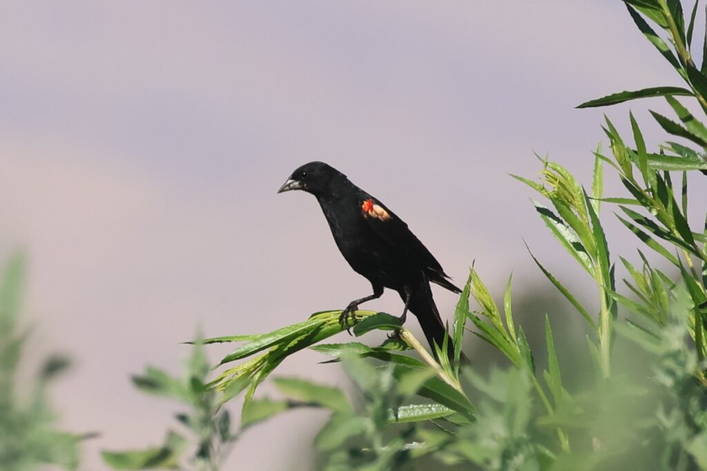
Traditional tracking methods—banding birds and hoping someone else catches them—returned data so rarely that a researcher might spend a career banding thousands of animals only to hear back from a fraction of a percent. Meanwhile, species like the tricolored blackbird have lost 95% of their population in the San Joaquin Valley, and scientists are still piecing together where they go outside of their breeding season and why.
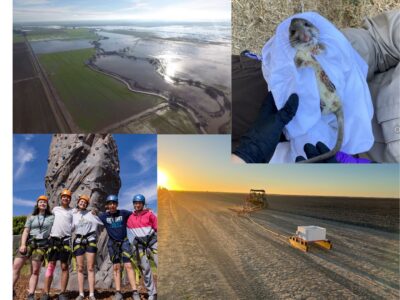
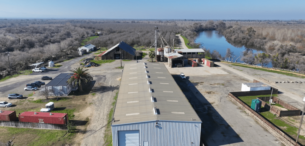
On January 14, multiple antennae were installed at Dos Rios State Park to receive signals from tagged wildlife. A week later a second station was installed at the 935-acre Panorama Vista Preserve (PVP) site River Partners restored north of the Kern River in Bakersfield.
Together, these stations, using the Motus Wildlife Tracking System (or, just Motus) will dramatically expand understanding of migration corridors in two ecologically important areas. By using Motus, we’re learning how to best rebuild lost linkages in globally important wildlife movement corridors that support the recovery of critically endangered species and keep common species that way.
With generous funding from the California Wildlife Conservation Board (WCB) for restoration planning and implementation across the San Joaquin Valley, River Partners is poised to learn more about how wildlife respond to restored habitats.

“The Wildlife Conservation Board is proud to support the installation of Motus towers at these restoration sites,” said WCB Executive Director Jennifer Norris. “Information provided by these towers is essential to ensuring restoration projects are planned and managed to benefit California’s birds, bats, and other flying species.”
Other key partners include Audubon California, California Department of Fish and Wildlife (CDFW), Southern Sierra Research Station, California State Parks, and Kern River Corridor Endowment (KRCE).
“Motus is an international network that’s successful because it’s a collaboration between so many people,” said River Partners Restoration Science Ecologist Dr. Sarah Gaffney. “River Partners couldn’t have done this without our partnerships.”
Motus, a program of Birds Canada, is a global research network that provides a structure to advance the study of the movement of tagged wildlife. Tags continuously emit signals that passive radio towers detect, feeding data into a shared international database. While a single tower provides limited insight, the power of Motus lies in the network’s scale.
The Power of Numbers
As of February 17, 2026, 2,395 Motus stations have picked up 484 species in 34 countries. California leads the U.S. with 129 stations, detecting 48 species—nearly double the stations of Pennsylvania’s 70. The new towers at Dos Rios State Park and PVP will give River Partners more information in these migration corridors than we’ve ever had.
Before Motus (Latin for “movement”) launched in Ontario, Canada, in 2014, tracking birds long-distance was difficult. Tagging birds with ID-laden bands was tedious, costly, and time consuming—often with little payoff. To boot, GPS and satellite tags were often too heavy and hampered wildlife’s movements.
“The way we traditionally track birds is by capturing them and putting a little aluminum band on the leg and then hoping another researcher captures it somewhere else and logs the bird’s ID,” Rogner said. “Personally, I’ve probably banded around 3,000 birds in my life and maybe 15 have been subsequently caught somewhere else.”
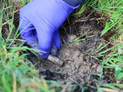
Motus streamlines tracking. Tags placed on animals (for River Partners’ purposes, a bird, bat, or butterfly) emit unique radio signal every few seconds. When a tagged animal enters the range of a tower, that tower is pinged and logs the tag’s unique ID, date, time, and signal strength. A short time later, that information is uploaded to a central database managed by Birds Canada.
“Motus towers are always running. This offers significant advantages over traditional radio telemetry, which required personnel to manually log tag detections with a handheld antenna,” said CDFW Senior Environmental Specialist Levi Souza. “You’d need a pretty intensive program of staff distributed around on the landscape to be able to do the work that a Motus station can do.”
Motus hardware is lightweight and efficient. Tags have solar panels or batteries or both, depending on the application. Bat tags are typically only battery, bird tags are typically hybrid and butterfly tags are solar only. Audubon California Working Lands Program Manager Ian Souza-Cole said these lightweight powerhouses allow researchers to track animals that are too small or light to carry GPS or satellite tags—traditional Motus tags weigh as little as 0.2 grams.
“The rule of thumb with tagging birds is you want the tag to weigh less than 3% of the bird’s body weight,” said Souza-Cole, who lent his experience and expertise to River Partners as a consultant and in building the tower at Dos Rios State Park.
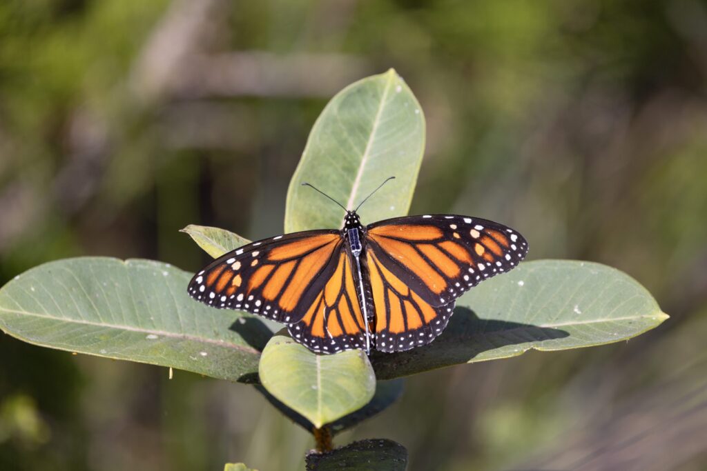
Butterfly tags are even smaller and lighter, weighing a feathery 0.06 grams.
“Those tags don’t have a battery, so they each have a little, tiny solar panel. The tag sends out a Bluetooth signal, and our towers will be able to collect radio telemetry data as well as Bluetooth data,” Rogner said.
The range of Motus towers can be extraordinary. With a clear line of sight, antennas can detect animals within 15-20 kilometers (9-12 miles), depending on the topography and any nearby impediments. By better understanding migration routes, stopover sites, and the timing of movements, scientists and conservationists can pinpoint habitats that need protection. This helps River Partners inform our future restorations and how we can better support threatened and endangered species.
Through the Motus stations, River Partners is ready to collect more information about how wildlife use and travel through our restoration sites. California State Parks Rivers Sector Manager for the Central Valley Paige Haller is thrilled Dos Rios State Park is poised to provide a wealth of information.
“Motus is a game-changing technology for agencies like California State Parks, because the sheer amount of data that’s widely available provides a richer look into wildlife species across the state and the country,” she said. “Knowing that Dos Rios, California’s newest state park, is contributing to a broader understanding of the many species visiting this region underscores the importance of collaboration.”
KRCE President Carolyn Belli is similarly thrilled to see what stories the PVP Motus tower can tell about wildlife in the lower San Joaquin Valley.
“It’s exciting to partner with River Partners on the Motus Wildlife Tracking System project at the Panorama Vista Preserve. It’s an honor to join this international conservation project for small migratory animals,” said Belli. “This project follows our Mission to preserve, protect, and enhance educational, recreational, environmental, scientific, cultural, and historic values in the Preserve for future generations. We look forward to seeing what impact the Preserve may have as part of this important project.”
The positive impact of the Motus towers at River Partners restoration sites will be felt instantly.
Filling an Important Gap
Looking at a map of Motus locations throughout the San Joaquin Valley, what stands out is the 100-mile gap between the Cosumnes River Preserve near Galt south to the Merced National Wildlife Refuge. Now, smack in the middle of that gap is the Motus tower at Dos Rios State Park.

“By filling in these bare spots with towers, it helps fill in the gaps for much larger questions other researchers are answering when they’re looking at migration across the Western hemisphere,” Gaffney said. “Having our towers in place will help provide more data points for their research questions.”
River Partners Director of Restoration Science Emma Havstad said one of River Partners’ restoration goals is to help endangered and rare wildlife persist or recover in the face of ongoing threats—knowing that our sites (like Dos Rios State Park and PVP) represent only one portion of their lifecycle and habitat.
“The Motus data helps us learn about the rest of the picture so that we can effectively address this urgent need,” she said. “Our projects don’t exist in a vacuum, and the wildlife we care about don’t adhere to our imposed boundaries. Motus data helps us understand the bigger picture and the context of our work.”
Rogner added that the data River Partners receives will build on existing long-term data sets and “help answer questions like how long birds do these animals live? How long does it take them to migrate? How much time are they spending at these stopover sites during migration? All those pieces of information will help us do better conservation.”
And while the data will certainly help River Partners and key partners learn more about many critters, one species of special interest is the tricolored blackbird, which has experienced a catastrophic population drop of more than 95% in the San Joaquin Valley. It’s listed as Threatened under the California Endangered Species Act. The new towers were installed where they can detect tricolored blackbirds’ signals as they transit between the Sacramento and San Joaquin Valleys.
Souza-Cole noted that while the tricolored blackbird is studied heavily in the breeding season, more needs to be discovered about what they do beyond that.
“We have a good idea where they breed, but examining their regional movements in the fall and winter is one intent of this project,” said Souza-Cole. “They’re not doing large-scale migrations, they’re staying within the state of California, but they’re moving about the landscape and using areas we might not know that well. Examining those movements and discovering novel things in that regard is exciting.”
Pat Lorch, Senior Research Biologist at Southern Sierra Station Research, also helped craft River Partners’ Motus plan and installed both towers. Stationed in the Kern River Valley, Lorch said that little is known about the interchange between the Central Valley populations of tricolored blackbirds and the one in the Kern River Valley.
“If we can see birds hitting the PVP antenna, then maybe the next antenna, then hitting some other antennas around the region, we could learn a whole lot more about these birds,” he said.
Adding Resolution to the Network
Souza with CDFW said being able to conserve all wildlife starts with knowledge about their habitats and working to preserve and maintain them.
“There are some species we think of as common that we don’t consider as migratory as others, but they still exhibit seasonal movement patterns and changes in habitat use from breeding life-cycle stages to overwintering life stages,” Souza said. “Getting that full annual picture of the habitats the animal uses is really important to understanding where we need to conserve land, where we need to do restoration projects, or where we need to put conservation dollars.”
Motus gives River Partners and other researchers a better idea of the habitats that wildlife use year-round. And when data points from hundreds of towers along migratory paths come together, it benefits research across the board.
“Motus is so strong because the stations are networked with the other stations in the region, so their work and contributions help other researchers in the region who are doing work on other species, those stations add resolution to the network,” Souza said. “There’s this inherent community benefit to participating in Motus.”
Wildlife habitat restoration and conservation are huge and complex tasks. Each region, state, and site is different from one another. But the Motus network offers a scalable path forward.
“The network exemplifies how conservation needs to happen going forward. We simply don’t have the resources to do all we need to do with the huge amounts of threats that species face,” Souza said. “There are too few of us, with too little money, so whenever we can leverage community-based work to advance science and conservation, those are really good opportunities.”
The knowledge gap is closing, and River Partners will continue to learn how to help bring back entire wildlife populations. Before, tagged wildlife would ordinarily fly and flitter unannounced through the San Joaquin Valley and drift out into the darkness. Moving forward, these birds, bats, and butterflies will share vital information with River Partners. A tower will ping, the signal will be logged, the data will be built, and we’ll get to see something we’ve never been able to see before.