Central Valley Chinook salmon are in serious trouble.
Multiple runs are listed under the Endangered Species Act, and populations have declined dramatically over the past century (and 90% in the last 20 years) as dams, diversions, and development have stripped away the cold water, food, and floodplain habitat salmon need to survive. Understanding exactly how juvenile fish navigate what remains of their habitat has never been more urgent.
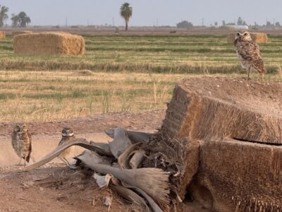
So, what if we could listen to the secrets juvenile salmon share about their migratory journeys? River Partners and prominent researchers are doing just that at Dos Rios Norte, our floodplain restoration site located 45 minutes north of Sacramento along a vital migratory pathway for all four runs of imperiled Chinook salmon. The 1,600-acre property, where Lundberg Family Farms is actively farming rice, is bordered by three critical bodies of water for salmon in the Sacramento Valley: the confluence of the Sacramento and Feather rivers and Lower Butte Creek.
Along with key project partners at the California Department of Fish and Wildlife (CDFW) as well as Center for Watershed Sciences and Department of Wildlife, Fish, and Conservation Biology at UC Davis, River Partners hopes to learn more about habitat usage for juvenile salmon and their migration routes along the Sacramento River. What we learn will ultimately help our ability to revitalize habitats that salmon depend on for survival.
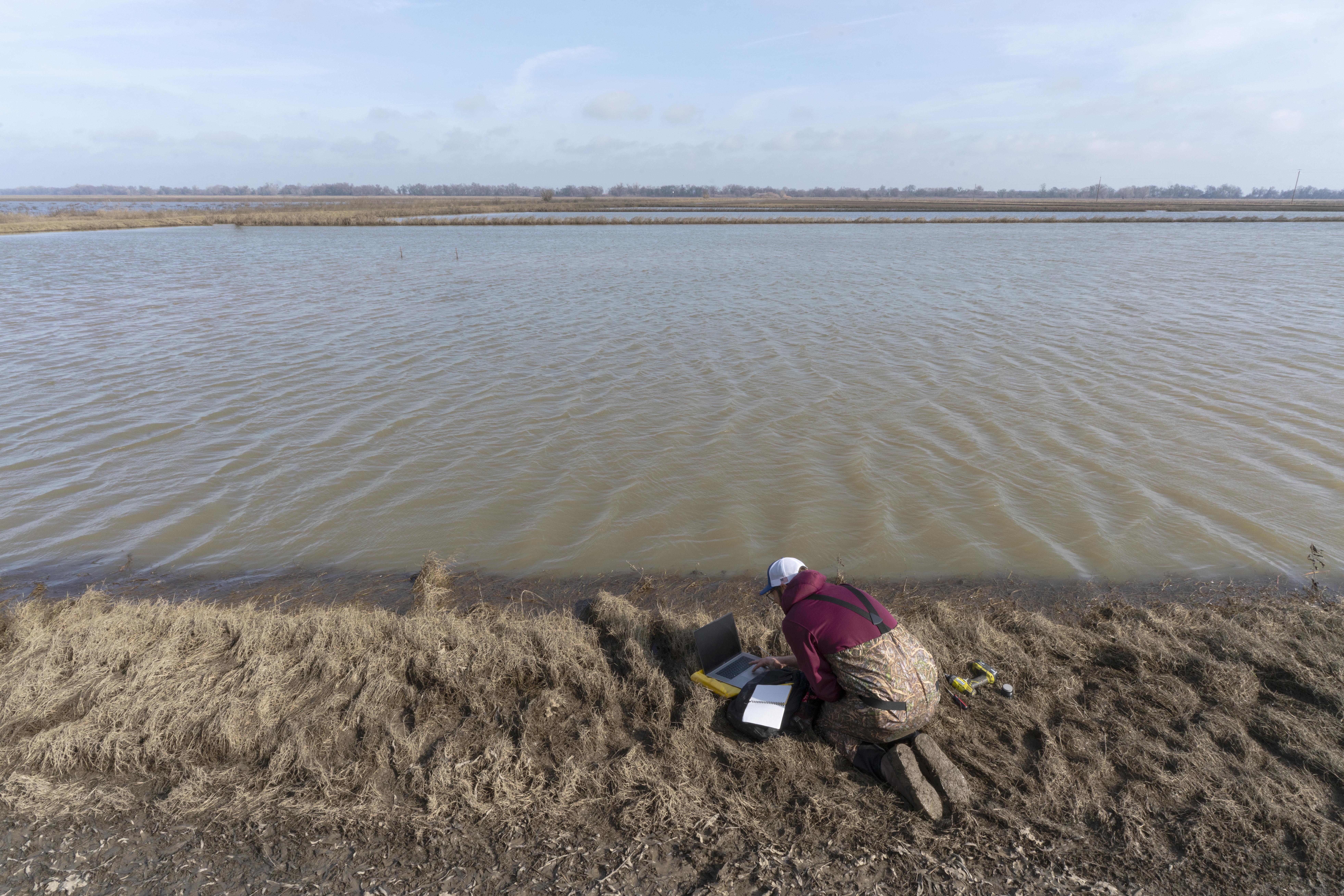
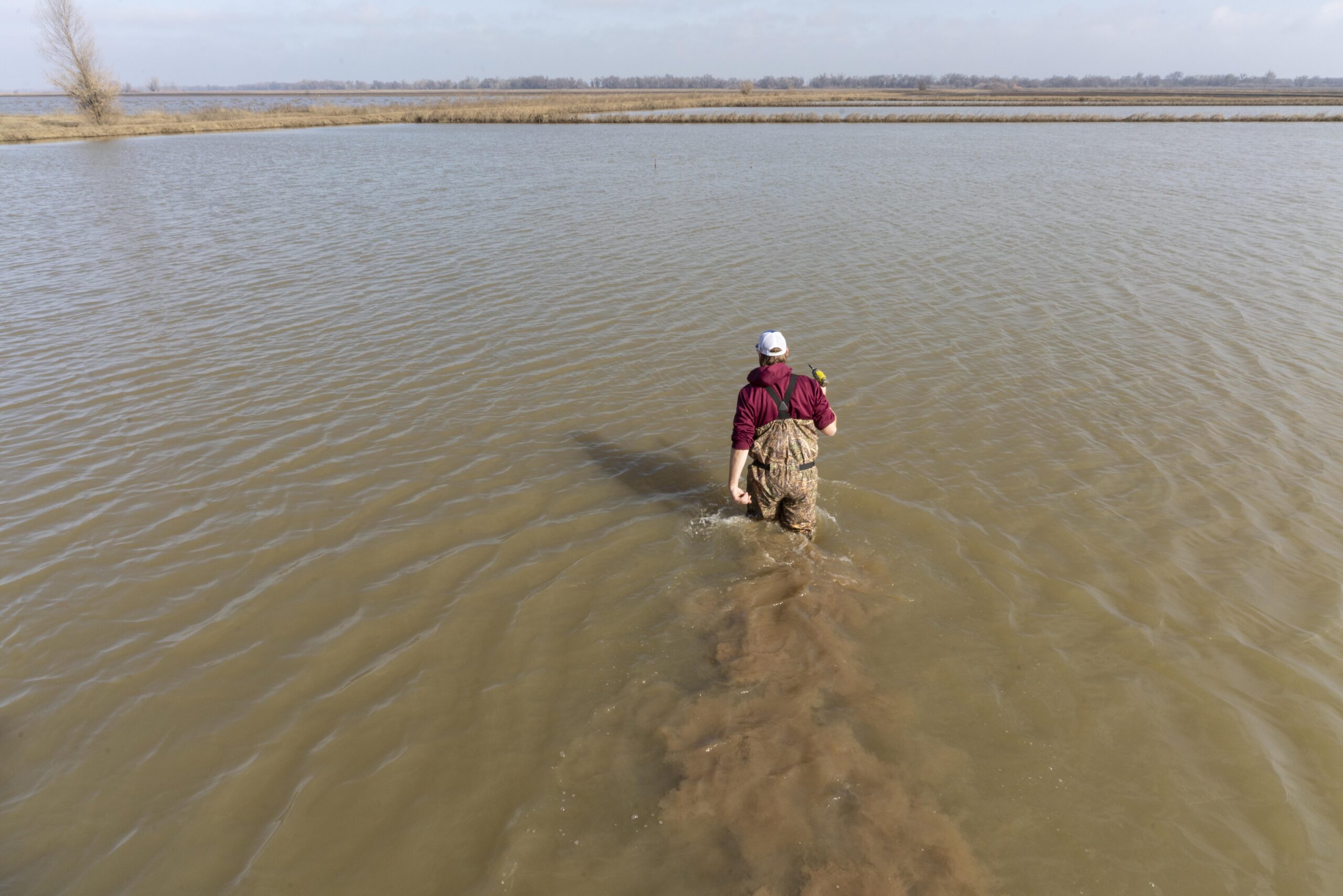
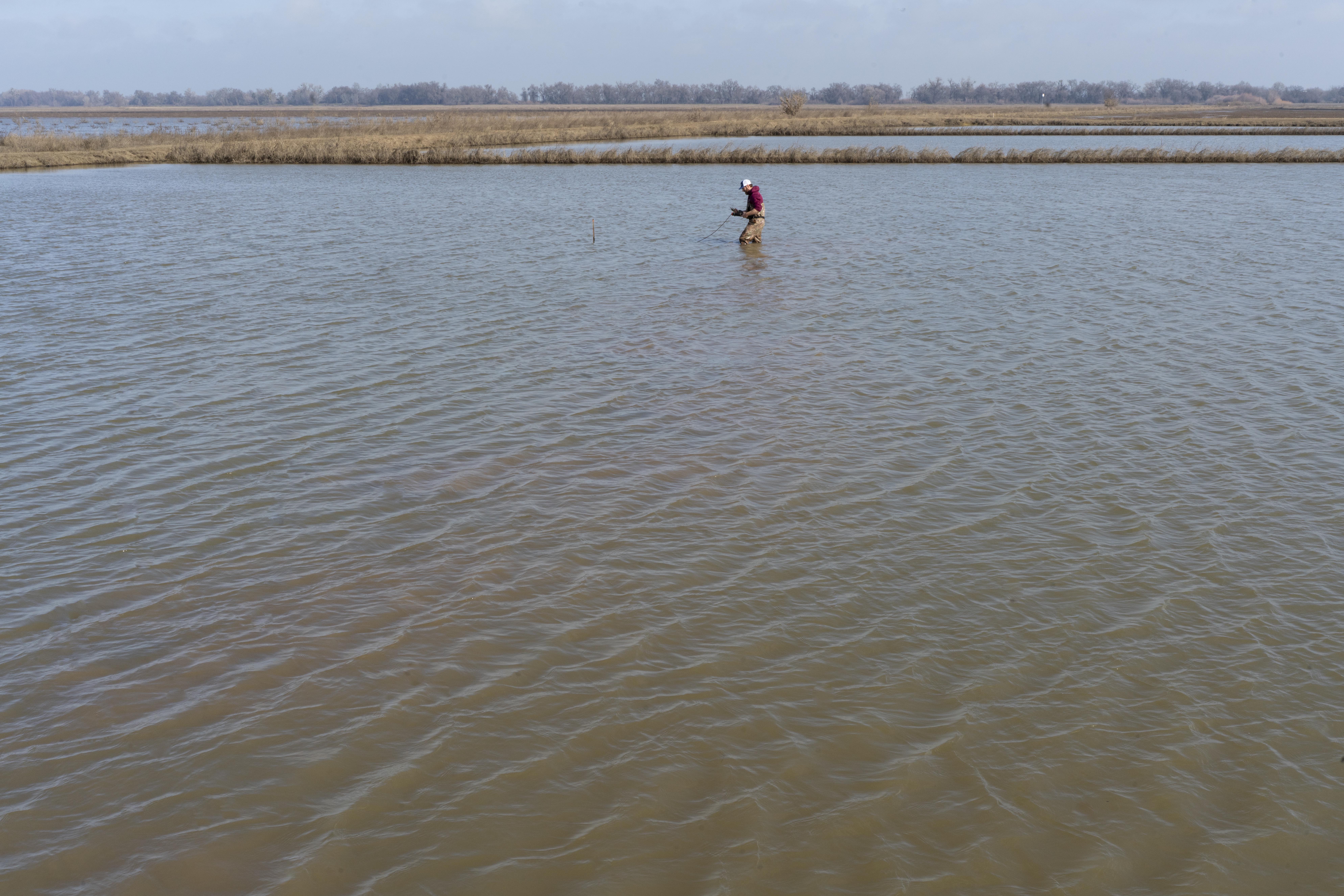
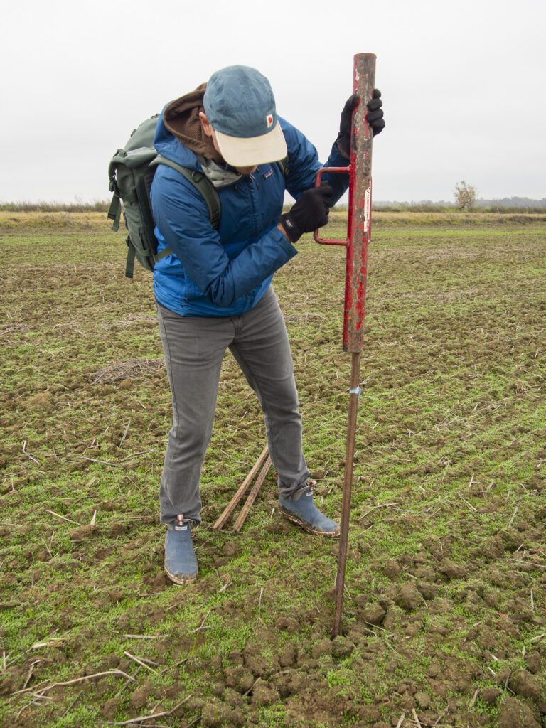
Using a juvenile salmon acoustic telemetry system (JSATS)—12 receivers were placed on stakes in the ground at Dos Rios Norte to detect signals from tagged juvenile salmon as they swim past. Each signal received from a tagged juvenile salmon provides the location, date, time, and tag ID, allowing us to retrace each salmon’s path. The crucial part: We’ll get to see where the fish entered the floodplain at Dos Rios Norte.
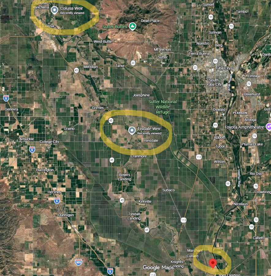
We know juvenile salmon use the floodplain here. The question is where they enter it and if River Partners can help make that easier for them by providing a more accessible on-ramp. The assumption was that most fish which end up in the lower Sutter Bypass from the Sacramento River enter it when the Colusa or Tisdale Weirs overtop (see map below). However, initial JSAT results indicate otherwise.
“A several-month acoustic telemetry study in 2023 suggested that’s not always the case,” said River Partners Senior Restoration Science Ecologist Mike Davis.
It’s a complicated journey and involves the Sacramento River and the adjoining weirs and bypasses.
The Unexpected Journey
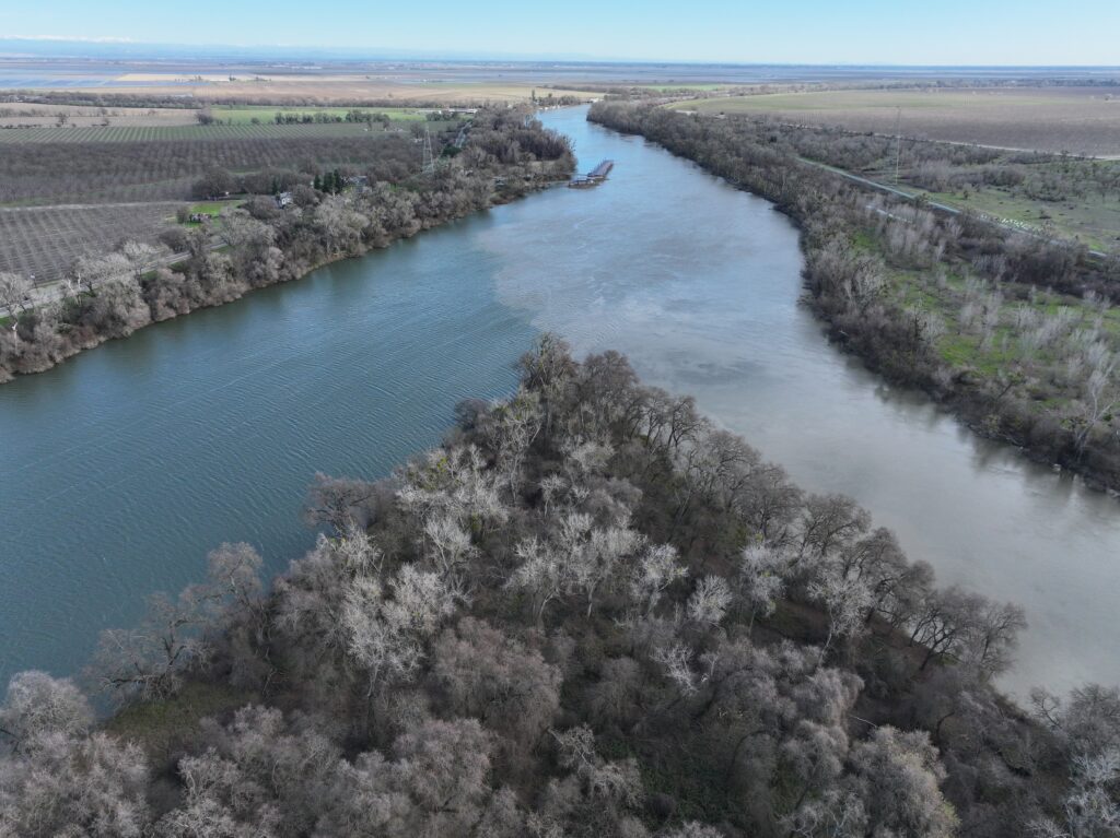
For millennia, the Sacramento River supported one of the most prolific runs of salmon on the West Coast. Over the past 200 years, the Sacramento River has been modified for irrigation and flood control and over 95% of historic riverside floodplain and wetland habitat—crucial nurseries and food webs that supported salmon—was lost.
Today, the Sacramento River system features six weirs and two bypasses, all man-made structures that take water off the river, help manage its flow, and reduce flood risk to Sacramento Valley communities.

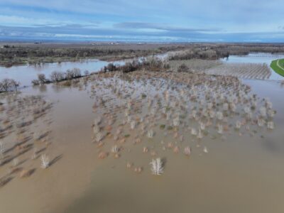
When the river rises enough, water overtops and meets the weirs to the east, which act as barriers. When the water overtops the weirs, it flows further east into the Sutter Bypass, a 30-mile-long channel that runs south, starting about 20 miles west of Yuba City and terminating at Dos Rios Norte, an essential area for all runs of Chinook salmon, including all four runs of Chinook Salmon in the Central Valley.
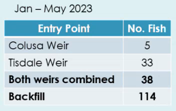
From January to May 2023, UC Davis led a study to see if tagged juvenile salmon entered the Sutter Bypass from the Colusa Weir (about 100 miles north of Sacramento) or Tisdale Weir (about 55 miles north of Sacramento), or remained on the Sacramento River long enough to reach the floodplain via the East Canal, which flows south of Dos Rios Norte, also called backfilling.
Using JSATS data, the 2023 study found that five JSATS-tagged salmon entered the floodplain via Colusa Weir and 33 more fish entered via Tisdale Weir. Meanwhile, a whopping 114 juvenile salmon entered the floodplain via backfill, a stunning number considering it was believed more fish got there through the weirs.
“It’s a really significant feature of the way the fish use the bypass under certain conditions, coming in from the bottom through Dos Rios Norte,” Davis said. “It means that this location as a key migratory pathway for fish utilizing high-value habitat in the Sutter Bypass is undervalued and should be given more management emphasis in salmon recovery efforts along the Sacramento River.”
Salmon recovery plans have historically directed resources toward weir management. But if the majority of fish are entering via backfill at the bottom of the bypass, restoration dollars and habitat improvements may have been systematically aimed at the wrong entry points. Davis posited that “these preliminary data suggest we should be thinking more about how to get more fish in from the bottom and to improve habitat conditions in the lower Sutter Bypass.”
That’s exactly what River Partners aims to do by restoring floodplain habitat at Dos Rios Norte.
Data to Support the Hunch
Acoustic telemetry receivers deployed in waterways throughout the Sacramento Valley (including the Sutter Bypass) illustrate how and where tagged fish move. Yet, before the 2023 study, there hadn’t been acoustic telemetry receivers at the bottom of the Sutter Bypass on Dos Rios Norte. Now, with additional receivers deployed there (each with a range of 100 feet), data is collected every day.
When flood season is over at Dos Rios Norte (mid- to late-spring), CDFW Senior Environmental Scientist Derrick Alcott will retrieve the receivers and download and process the data, to share findings by mid-summer.
If the findings show that juvenile salmon consistently enter the lower Sutter Bypass via backfilling (not entering it from the upper portion of the Sutter Bypass), Davis imagines improving aquatic habitat connectivity between the Sacramento River and Dos Rios Norte so fish can get there sooner and stay longer. He had the hunch, and soon he’ll have the data.
“That was always an idea in my mind that theoretically this is something that should help, but now we actually have the data, and we’ll have more soon,” Davis said. “It provides real numbers to a theory we’ve had, and now we can translate that into a project that will make improvements on the landscape to benefit fish.”
Floodplains are Complex
Juvenile salmon evolved to utilize floodplains and their habitat, which made up much of the Sacramento Valley before development changed that, for food, rest, and safety.
“Humans have altered our landscapes and riverscapes so much that there’s very little natural floodplain left in California,” Alcott said. “We’ve designed them to go away, which means by and large, the fish don’t have access to the floodplains they historically evolved to utilize, and the vast majority of the floodplains we have left are these engineered flood bypasses.”
Studies show that when salmon have access to inundated floodplains with abundant riparian vegetation, it supports population diversity and resilience, two attributes that must be improved to recover Central Valley salmon. And without access to productive floodplains, juvenile salmon enter the ocean smaller, less healthy, and far less likely to survive to adulthood and return to spawn—a cycle that, continued long enough, inches already imperiled runs closer to extinction.
Findings from this project will be vital to helping River Partners’ approach to restoring Dos Rios Norte, which will play a vital role in the future of juvenile salmon here.
UC Davis Center for Watershed Sciences Senior Researcher Carson Jeffres said that understanding how fish move across the landscape is one of science’s big questions, particularly juvenile fish that are so small that they’re oftentimes overlooked or not collected.
“By using acoustic telemetry, we know where they started,” he said. “And through the array that is set up through the Sacramento Valley, we have the sequential events of how they move through.”
UC Davis Professor of Physiological Ecology Nann Fangue said floodplains are naturally dynamic and complicated, with conditions varying from year to year—an aspect of this project she finds so exciting.
“Everybody wants a yes or a no, or they want to flip something on or off, or they want these simple answers. And that’s the opposite of how biology and ecology work,” Fangue said. “To me, this project is so cool because it embraces dynamism.”
Fangue added that her students are “craving” hands-on experiences like these. Alex Wampler, a third-year Ph.D. candidate at UC Davis, said she feels fortunate to have the opportunity to work on acoustic telemetry research. She’s excited about what the next data reveal and what the project partners can learn from it.
“The fact that the fish are using the Dos Rios Norte floodplain even when the weir is not topping, they’re still able to utilize those floodplains, really shows so much,” she said. “We know that the fish are here, even if it’s not in the way that we expected. To me, that’s very exciting, and it shows that fish find a way.”
And when the fish share their migratory secrets, we will be listening.