Groundwater is California’s hidden lifeline, supporting agriculture, drinking water, and ecosystems. Yet, over the past century and a half, unsustainable water use has led to depleted aquifers, land subsidence, damage to infrastructure, streamflow depletion, and dry wells, threatening both human and environmental health.
In fact, rates of groundwater decline in California are some of the highest in the world. Four groundwater basins in the San Joaquin Valley rank among the world’s most rapidly declining aquifers, according to research published this year.
“Groundwater depletion is a landscape-sized problem,” says River Partners President Julie Rentner. “We need landscape-scale correction.”
As the state grapples with climate change, more frequent and intense droughts, and diminishing snowpacks, forward-thinking solutions are essential for sustaining precious water resources for future generations.
River Partners and a coalition of science partners from Lawrence Livermore National Laboratory, Stanford University and CSU Stanislaus are at the forefront of groundbreaking research looking to nature—and our rivers—to advance groundwater recharge across California.
Nature Holds the Key To California’s Sustainable Water Future
“If you look carefully at climate scenarios for river flows, the peak flows are incredibly high,” says Lawrence Livermore National Laboratory research scientist Dr. Ate Visser. He’s part of a team of researchers working across multiple institutions and disciplines to advance our understanding of how restored floodplains contribute to groundwater recharge.
Giving rivers more room and allowing floodwaters to spread out and percolate underground is a “very smart approach,” according to Dr. Visser, because it “leverages nature rather than just using concrete.”
Climate science tells us California’s precipitation will become more punctuated, with more intense atmospheric rivers and longer dry spells between them. Dr. Visser says reservoirs can buffer some of those flows, but if we can get rivers to expand and enable restored riverside landscapes to take on that water safely, we’ll protect downstream communities while creating co-benefits—including groundwater recharge.
“When you think about the stacked benefits—groundwater recharge, improved water quality, flood safety, wildlife recovery, parks, recreational opportunities, and carbon sequestration—investing in floodplain restoration is the best thing for the long-term health of Central Valley communities and the best way to spend public dollars,” says Rentner.
One of the critical insights driving this approach is recognizing that groundwater and surface water are interconnected. “Groundwater and surface water are the same water, and need to be managed as one resource,” says River Partners Senior Director of Conservation John Cain. “For too long we’ve managed them separately.”

Yet, there’s very little data that measures exactly how rivers and restored floodplains are capturing water and storing it underground. Simply put, no one has ever demonstrated that if you “purchase a few thousand acres and make it more wet,” as Rentner points out, “neighboring wells are less likely to go dry during a drought.”
That’s precisely the goal of the research team led by River Partners. “We’re trying to demonstrate that if we can keep more water in rivers during dry times, and especially widening them during wet times, we can do landscape-scale water recharge that will benefit first the people closest to the river, but over time, people all over the valley who have wells that need water,” says Rentner.
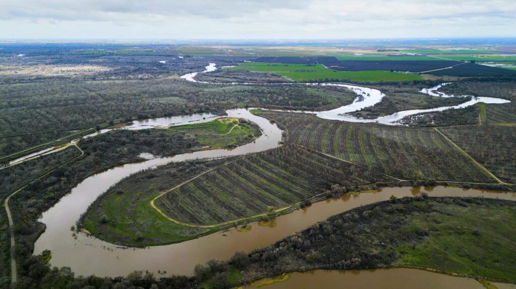
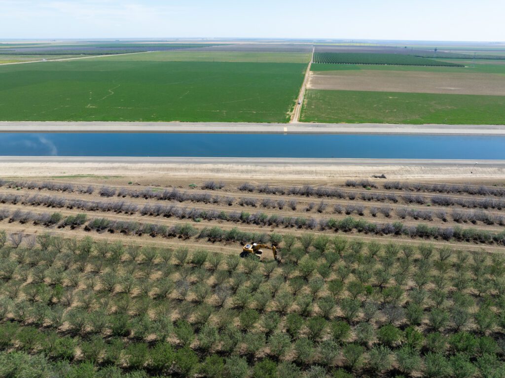
Utilizing part of a one-time allocation of $40 million in last year’s state budget for floodplain restoration in the San Joaquin and Tulare basins that’s being administered by the California Wildlife Conservation Board, our joint groundwater research study will identify the best locations for recharge. The study will also identify how much water is being captured underground when restored and reconnected riverways do flood.
When you think about the stacked benefits—groundwater recharge, improved water quality, flood safety, wildlife recovery, parks, recreational opportunities, and carbon sequestration—investing in floodplain restoration is the best thing for the long-term health of Central Valley communities and the best way to spend public dollars.
Julie Rentner, River Partners President
Ultimately, if we can quantify the groundwater recharge benefits of River Partners’ statewide river restoration efforts and point to more locations that we know provide a fast-path for recharge, we can not only create more durable restoration areas, but we can also help open the floodgates, so to speak, for both public and private support of nature-based solutions for groundwater sustainability.
A Confluence of Research Science
The groundwater study, which kicked off in January of this year and will run through March 2026, combines three methodologies and institutions with River Partners’ expertise in ecological restoration to deepen the collective understanding of the surface water and groundwater dynamic associated with floodplain restoration.
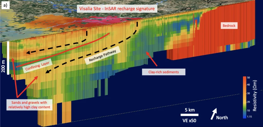
Dr. Rosemary Knight, a professor in the Geophysics Department at Stanford University, is conducting hydrogeophysical mapping of floodplain restoration sites, Lawrence Livermore National Laboratory is using geochemical isotope tracking to trace water sources, and Dr. Horacio Ferriz, a professor at CSU Stanislaus is analyzing flood hydrology near the restored Dos Rios complex.
“Mapping groundwater recharge is a complex task that requires cutting-edge technology and a deep understanding of the local geology,” says Dr. Knight. Her research lab is using a towed transient electromagnetic (tTEM) imaging method to map floodplain restoration sites to understand how water might move in the top 60 meters below the ground surface. “Our collaboration with River Partners is crucial in ensuring that our scientific findings translate into real-world solutions.”
Meredith Gobel, a research scientist who works closely with Dr. Knight at Stanford University, adds, “It’s really exciting to work with River Partners. We’re having a positive benefit for recharge, but there’s all these other additional benefits of flood protection and habitat restoration and more.”
Dr. Knight’s team is deploying the tTEM on yet-to-be-restored areas to map sediment layers suitable for recharge. An example of such layers includes those deposited in channels carved by ice age rivers and now underground, sometimes called “paleovalleys,” which are key to recharging California’s depleted groundwater. This research helps determine what benefit floodplain restoration could have in terms of recharge by finding the pathways water may take from the surface to the water table.
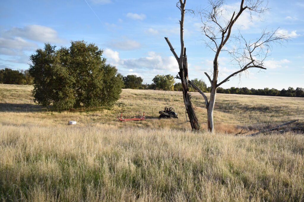
Knight’s team is working at planned restoration sites near the 1,600-acre Dos Rios State Park west of Modesto, which River Partners restored to thriving native habitat over more than a decade, as well as other potential restoration sites in the San Joaquin Valley.
In addition to subsurface mapping that will help River Partners identify the best locations for potential recharge, we’re partnering with Lawrence Livermore National Laboratory (LLNL) to use chemistry to trace the fingerprint of water on restored floodplains.
“My group at LLNL has developed new capabilities for utilizing isotopic tracers in hydrological research and applied these tracers to urgent water resource questions in California,” says Dr. Visser. His team is focusing on the restored areas around Dos Rios State Park to see how much water travels underground during flood events, and where it’s coming from.
“Knowing we can use our very niche skillsets to help provide solutions is personally important and helps deal with general climate anxiety,” says Lawrence Livermore National Laboratory science researcher Jory Lerback.
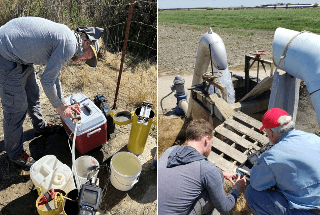
(Right) In May 2024, Dr. Ate Visser and Dr. Horacio Ferriz of CSU Stanislaus measuring temperature, pH, specific conductivity, and dissolved oxygen using a multiparameter probe for a groundwater sample collected from an existing well. The isotopic analysis of the groundwater sample can tell researchers how fast water travels through an ecosystem, the age of existing groundwater, how groundwater interacts with surface water, and the cause of contamination or pollution detected in water sources. Photos courtesy LLNL.
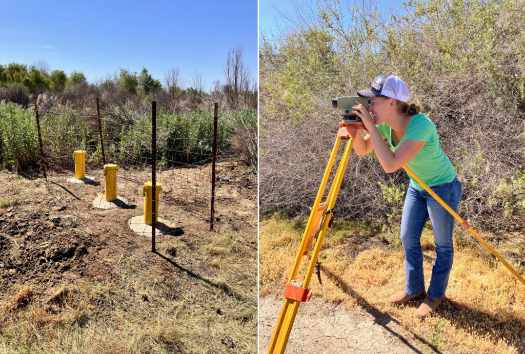
Rounding out the trio of research teams contributing to the study is Dr. Horacio Ferriz of CSU Stanislaus and his students, some of whom are interning for the summer at River Partners through our Restoration Scholars program. In collaboration with LLNL, they will analyze the hydrology of the restored floodplain at the Dos Rios Complex. They installed piezometers, or shallow wells, at multiple distances from the river channel to understand how surface water from the nearby San Joaquin River is infiltrating deep into the ground, and vice versa.
“I see this project as a coordinated whole,” says Dr. Ferriz. “We are going to understand the way in which surface hydrology of the San Joaquin and Tuolumne rivers and groundwater hydrology are linked.”
“It’s Heartbreaking”: What’s at Stake
Historically, California landowners have been allowed to pump as much groundwater as they could put to beneficial use, without regard to the impact on neighboring wells, aquifers, or ecosystems.
“A lot of folks have made bad calls based on incomplete information and shortsightedness that have drained river channels, and thus the associated aquifers, to the detriment now of tens of thousands of people and hundreds of communities,” says Rentner.
The effects of groundwater depletion are “genuinely heartbreaking,” according to Jake Harm, a researcher working with Dr. Visser at LLNL. Harm recently completed a master’s thesis on dry wells in the San Joaquin Valley. “The human toll these situations are creating is right in front of us and impossible to ignore,” he says.
While reviewing data, Harm read through comments left by people with dry wells in the California Department of Water Resources’ Dry Well Reporting System database. “They would write, ‘My well’s gone dry. I haven’t had water in six months. I don’t know what I’m going to do. I can’t afford $30,000 for a new well,’” he said.
Groundwater basins provide about 40% of water for California’s farms and communities on average, and even more during dry years. Around 85% of Californians depend on groundwater for some potion of their water supply. This is particularly true in rural and underserved communities where municipal water systems are less common.
The human toll these situations are creating is right in front of us and impossible to ignore.
Jake Harm, Lawrence Livermore National Laboratory Researcher
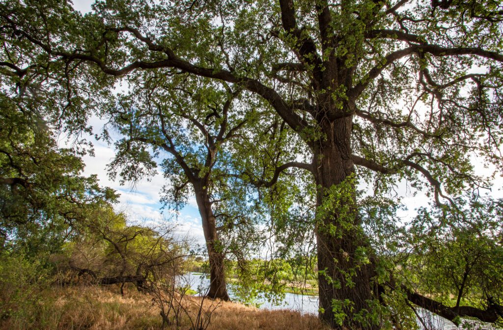
People aren’t the only ones affected by groundwater depletion. Groundwater-dependent ecosystems, such as oak woodlands which cover much of the state, depend on groundwater for survival. When too much groundwater is pumped out of the aquifer, the water table drops below the roots of trees, sometimes killing trees that have lived for decades, or even centuries.
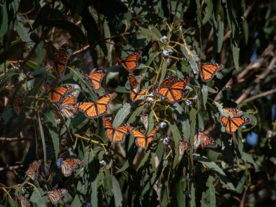
Groundwater can also replenish rivers and streams that would otherwise run dry during certain times of year, making it possible for imperiled wildlife like steelhead and salmon to survive. Today, more than 80% of California’s 122 native fish species are experiencing population decline and some are on the brink of extinction—or have already been lost.
The depletion of groundwater also devastates lands traditionally stewarded by Native Californians. For example, the Tachi people, who once thrived along the banks of Pa’ashi (Tulare Lake), saw their way of life disappear when settlers drained the lake to support a thriving agricultural industry. Recent floods in 2023 revived the lake, symbolizing a renewal for the Tachi people.
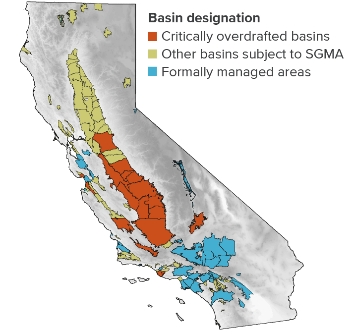
In 2014, California passed the landmark Sustainable Groundwater Management Act (SGMA) that regulates California’s groundwater for the first time and is aimed at preventing groundwater overdraft in the state’s 450 groundwater basins by 2040. Yet, while progress towards groundwater sustainability is underway, we’re still falling short. Recent data shared by the Public Policy Institute of California shows perennial crops are expanding their footprint, and reports of domestic wells going dry rose by about 30% in the latest drought.
Advancing a Fast, Scalable Solution at Just the Right Time
“Floodplain restoration has to get done across the valley at scale, and there’s no one else stepping up to do it,” says Rentner. “Those river channels are the fastest way to get water back in the ground if we can build the collective will to put water in those river channels in the winter and spring when they normally would have been wet. We can recreate some of the lost pressure that artesian wells relied on, and we’ll see regional groundwater levels rising.”
Solving California’s groundwater crisis requires a paradigm shift in water science and management. By recognizing the interconnectedness of surface water and groundwater, leveraging the power of restored and reconnected rivers, and focusing on natural solutions where they’ll have the greatest impact, we can help recharge our aquifers for ecosystems and communities. River Partners and our partners are at the forefront of this movement, demonstrating that with the right vision and collaborative effort, we can secure a sustainable water future for California.
“People look and realize what huge mistakes were made in the last 100 years,” says Dr. Knight. “We’re trying to understand how nature works so we can heal in a way that’s nature-centric.”