Californians have a long history of hoping and praying for water to end the state’s ongoing cycle of drought. Then, this year’s unprecedented wet winter ended the worst drought on record. And now, we face a potentially even warmer and wetter El Niño winter. We wanted water, but are we ready for the storms ahead?
In addition, the threat of the “Big One” looms on the hopefully distant horizon: a worst-case-scenario megastorm that could cause catastrophic flooding statewide. We know it’s going to happen, but we don’t know when. Should we be scared? Is California prepared?
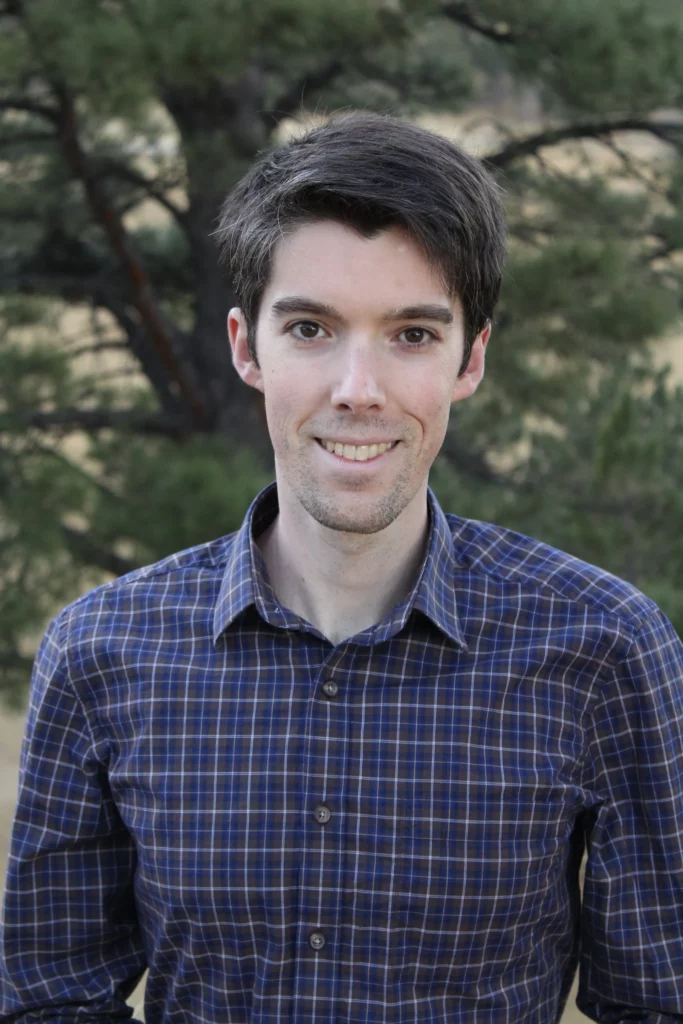
For this two-part blog series, River Partners sat down with extreme-weather researcher and climate scientist Dr. Daniel Swain, author of the Weather West blog, to share insights into the realities of a changing climate.
- Part 1 – Climate Reality Check with UCLA’s Dr. Daniel Swain
- Part 2 – We Can’t Build Our Way Out: Nature-Based Solutions to Adapt to a Changing Climate
In part one, below, we dive into the forces shaping California’s extreme weather, the potential impacts of another wet winter, and the risk of a megaflood event.
In part two, we talk with Dr. Swain about the power of multi-benefit floodplain restoration that River Partners continues to scale statewide to protect communities from flooding, boost groundwater and water security for the dry years ahead, and protect the natural systems that are our first line of defense in a changing climate.
As Dr. Swain shared, sometimes the science conversations can scare you a little bit. But that might just be a good thing, especially if it sparks urgently needed action to tackle the problem.
Part 1
Climate Reality Check with UCLA’s Dr. Daniel Swain
What kind of weather are you expecting to see this winter in California?
Dr. Daniel Swain: What we have this year is a historically unprecedented combination of things globally. We have global ocean and atmospheric warmth at a level that we’ve never seen before. It’s record-shattering. It’s genuinely remarkable. It’s way off the charts.
Interestingly, California has not been way off the charts hot this year. It’s almost the only place on Earth that hasn’t been. But almost everyone else has been extremely warm, and the Pacific Ocean is extraordinarily warm.
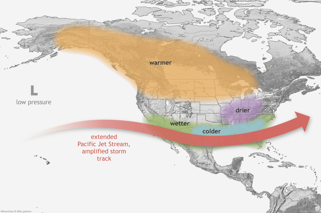
In the tropical Pacific Ocean, that’s largely because we have a strong or very strong El Niño event that is now rapidly developing and expected to peak right during winter, right when it might have the strongest impacts for the West Coast.
But we have this other thing going on: We have these patches of record-breaking ocean warmth elsewhere, not associated with El Niño, that are associated essentially with global warming. And it’s not entirely clear how those are going to either amplify or interfere with the effects of this strong El Niño event this year.
On the one hand, those warmer oceans in those patches are going to contribute even more water vapor to the atmosphere. So those are sort of supercharging the atmospheric sponge this year. So whatever storms do form are probably likely to be warmer and wetter than they would be otherwise.
That’s definitely a factor in the column of “Uh oh, look out this winter” in Central and Southern California in terms of flood risk.
What’s the likelihood that these influences line up to deliver a severe warm and wet winter?
It remains to be seen which of these factors wins out.
There’s the supercharged oceans essentially juicing up the atmosphere and giving us warmer, wetter storms. Then there’s the possible influence of a strong east-based El Niño giving us a stronger subtropical jet stream in Central and Southern California and further amplifying storm intensity and frequency. But then, there’s the potentially mitigating factor of these warm oceans messing up that jet stream part of it.
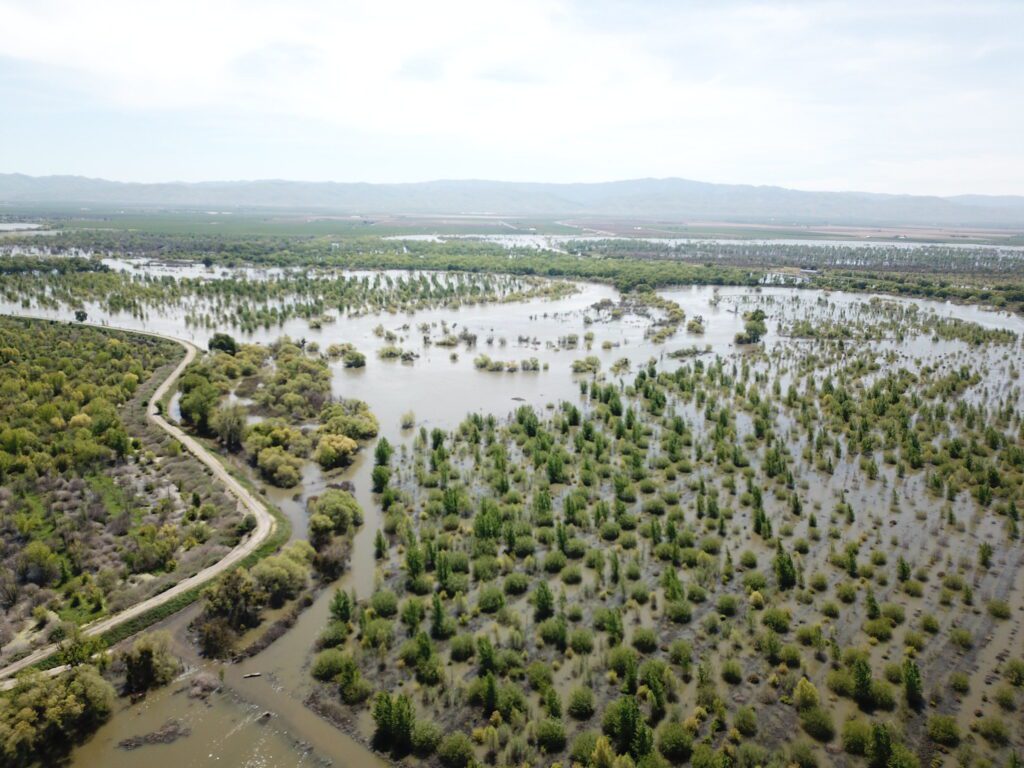
So, all put together, there’s a lot of uncertainty. But I think given the current antecedent conditions– we’re quite wet from winter, spring and even into the summer in some parts of Central and Southern California.
Soils are, if not saturated, much damper than they usually would become early in October. Reservoir levels are much higher than they have been in many years. And, there’s still some water in the Tulare Lake basin.
That’s the stage for a winter where there’s a tilt in the odds towards wetter than average conditions in this precise part of the state.


What differences or similarities are you seeing compared to last winter? Are you concerned?
The antecedent conditions are very different than last year. We were very lucky from a flood perspective that last year we went into it record-dry. While there’s no guarantee of a very wet winter, the odds of a very wet winter are higher than usual, and in particular, those storms are much more likely to be warmer storms than last year—not necessarily extremely warm ‘Pineapple Express’ storms, but it’s very unlikely we’ll see the kinds of very cold storms that bring these huge snow accumulations to low elevations.
That was a further saved-by-the-bell factor last year. Things were dry going into it, and these storms tended to be pretty cold for the most part, so you didn’t get the runoff instantly. This is the year where we have antecedent conditions that are wetter, and El Niño is more likely to increase precipitation in the southern half of the state this winter. And it’s also likely to make those storms that do arrive warmer than they otherwise would be.
So those three factors together–and the ongoing flood- and water-related impacts in Central and especially in the San Joaquin Valley—those do ring some tentative alarm bells. Again, it could go either way. It might not be super wet this winter, but to the extent that we have any predictability about this, this is the kind of sequencing that would be something that I think we should be paying close attention to.
How do you expect California’s climate to change in the future?
In California, we expect hydroclimate extremes to become even more variable. So, even greater swings between extremely wet and extremely dry conditions. Not just from season to season, but year to year.
And, we are already starting to see it. Look at the last 10 years for example: Different parts of California have seen by far the driest single years on record, as well as the wettest years on record. Both of those years have now occurred in the last decade. And, in a couple of cases, it has occurred more than once. We hit that driest year on record once in the past decade, and then exceeded it again a few years later.
And the same thing with the wet extreme. We expect to see more extreme precipitation events, more extreme winter storms, and perhaps, at least occasionally, more extreme non-winter storms.
Take this year for example, when most of Southern California saw its wettest summer on record. Tropical Storm Hilary dropped several inches of rain in a single day. Even in downtown Los Angeles, that was the wettest summer day in history in Southern California going back to the 1800s.
A remarkable day—definitely not the typical rain pattern in California that we see, but nonetheless an example of how a warming climate acts like a progressively larger sponge.
Can you explain the “progressively larger sponge” analogy?
If you have a progressively larger kitchen sponge, and you spill a progressively larger amount of water on your kitchen counter, that progressively larger sponge is going to be able to absorb more and more water. Which is great if you’re trying to clean up a mess in the kitchen.
But that increasingly larger sponge, if it’s saturated and you wring it out, it’s going to produce more water. That’s the primary reason why extreme precipitation events are becoming even more extreme in a warming climate.
That means the potential evaporation, or the amount of water the sponge can soak up, is also increasing. This vapor-pressure deficit we sometimes hear about, what that really means, is the increasingly larger sponge’s propensity to hold more water vapor in a warming climate.
These are two sides of the same thermodynamic coin, as I like to say. It explains, in a relatively easy to understand way, why both droughts and floods in a warming climate are likely to get worse in California, even if the average precipitation doesn’t change greatly.
What does this “progressively larger sponge” mean for how California approaches flood management?
I think we need to think big, partly because climate change is increasing the risk of big floods. That much is abundantly clear at this point. But also, we got kind of lucky in the 20th century. We did not observe the full range of variability that was possible even in a cooler climate. We know this because of what happened in 1862. We have not had an 1862-level flood since 1862. And 1862 is pretty much before there was much human influence on climate.
So, was 1862 climate change? Folks ask me that all the time as a “gotcha.” No, it wasn’t.
But that’s not great news because it means that we designed a lot of our systems with that level of flooding as an afterthought. We haven’t tested them with anything that big. We know that even without that exponentially expanding sponge, that level of flooding was possible before the sponge started to get bigger.
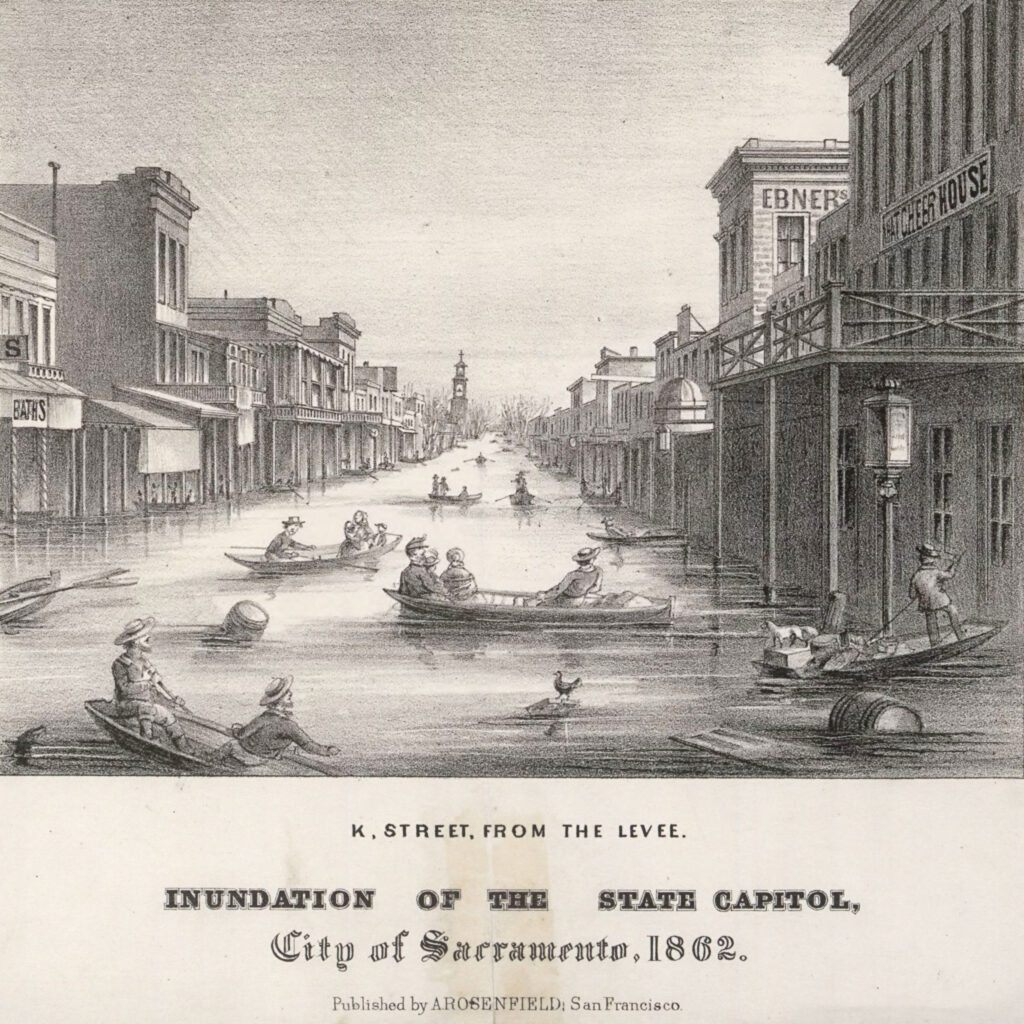
What is the modern equivalent of the Great Flood of 1862, or a once in a century-or-two flood event, given the changing climate? And are we prepared for that level of catastrophic flooding?
Yikes—take 1862 and scale it up further. What that does to California’s people, to its water systems, to its ecosystems: that’s what we’ve been pursuing with ArKStorm 2.0. Of course, with some matter of difficulty gaining traction and interest. Funding is the real challenge.
We were caught a little bit flat footed when it came to the rapid acceleration and wildfire severity and the extent of the human toll this past decade. Nobody in California or even modern North America had ever experienced a wildfire that just took out an entire town of tens of thousands of people, or killed dozens of people, or burned over 10,000 structures in a day. And then it happened. And now we’re forced to confront the reality of that.
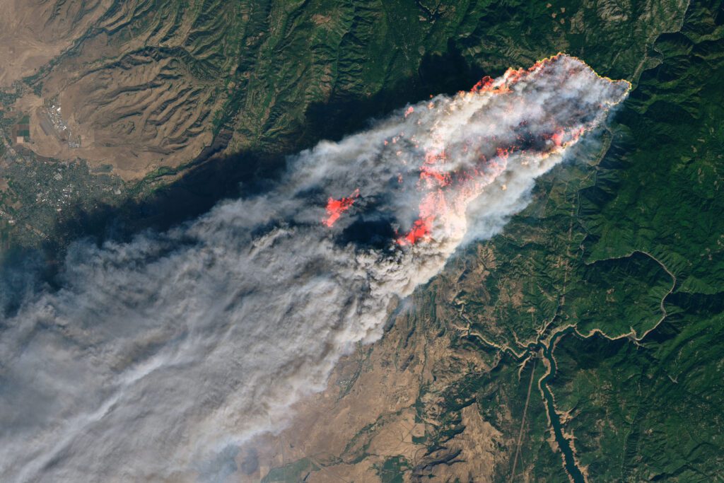
We weren’t ready even though it was at least partially foreseeable.
I think that’s where we are with the risk of severe flooding in California today. But we’re still in that window before it happens. And so, one of the things that we’re trying to do by shouting from the rooftops is hopefully move that needle before we have that decade where we’re shocked into action.
Because really what that will mean is some pretty bad things, as happened with wildfire, would maybe have to happen. So, our goal is to skip that step and really get the ball rolling on these kinds of interventions before the bad stuff happens. Because eventually it will.
We’re just not thinking about severe flooding in the same way that we are about severe drought and severe wildfire.
The flood risk side of things, the increasingly warm and wet atmospheric river side of things won’t happen every year, but it will happen in some years. And this year 2023-2024 is actually a good example of a year where we might see some big things happen.
River Partners will publish and share part two of our series, “Preparing for California’s Changing Climate,” in November.