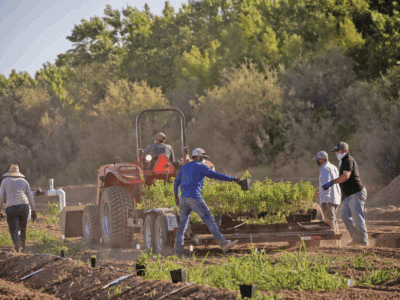
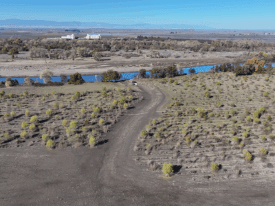
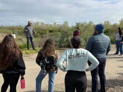
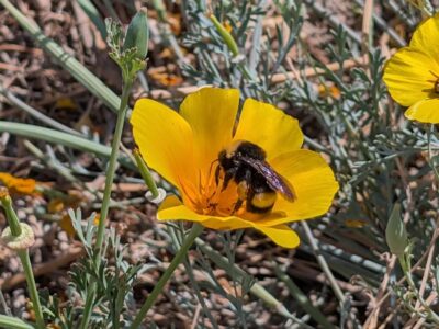
From rejuvenated rivers and reconnected floodplains to the return of native vegetation, habitat, and wildlife, the positive impacts of River Partners’ multi-benefit restoration can be seen throughout the state.
But we’re also doing work where it can’t easily be seen—underground.
Along with scientists from Stanford University, River Partners is getting a glimpse of the aquifer secrets beneath our feet—and beneath our restoration sites in the San Joaquin Valley. Using the towed time-domain electromagnetic (tTEM) imaging method, which is essentially a big MRI of the ground, the goal of our joint data gathering is to understand how water moves from the surface to below the ground to refill depleted aquifers and increase water supplies critical to California’s environment, communities, and economy.
Along with the collaboration with scientists from Stanford, we are working with science partners from Lawrence Livermore National Laboratory (LLNL) and CSU Stanislaus looking to nature—and our rivers—to advance groundwater recharge across California.
Our joint groundwater research efforts will work to identify the best locations for recharge. While LLNL is using chemistry to trace the fingerprint of water on restored floodplains, researchers at CSU Stanislaus are analyzing the hydrology of the restored floodplain at our Dos Rios Complex, installing piezometers, or shallow wells, at multiple distances from the river channel to understand how surface water from the nearby San Joaquin River infiltrates deep into the ground, and vice versa.

“Groundwater basins in the San Joaquin Valley are considered critically overdrafted and groundwater depletion can have severe negative consequences,” said River Partners Restoration Science Ecologist Dr. Sarah Gaffney. “Anything we can do on the ground, such as restoration, to prevent land collapse and subsidence, and promote recharge, is incredibly important.”
This puts River Partners at the forefront of groundbreaking research to advance groundwater recharge across California. And if we’re going to learn how best to plan restoration on historic floodplains and encourage groundwater recharge, Dr. Rosemary Knight, whose lab is conducting the tTEM research, said this method of research is critical.
“Mapping groundwater recharge is a complex task that requires cutting-edge technology and a deep understanding of the local geology,” said Dr. Knight, a professor of geophysics in the Stanford Doerr School of Sustainability. “Our collaboration with River Partners is crucial in ensuring that our scientific findings translate into real-world solutions.”
Using state funding for floodplain restoration in the San Joaquin and Tulare basins administered by the California Wildlife Conservation Board, this joint groundwater research study will identify the best locations for recharge. The groundwater study began in January 2024 and will run through March 2026.
We know that restored floodplains lead to restored groundwater. What we want clarity on, though, is where aquifers have the greatest potential for groundwater recharge, the most efficient path to recharge, and how to best maximize our future restoration in the San Joaquin Valley and beyond. Knowing this will help increase the pace, scale, and benefits of our work.
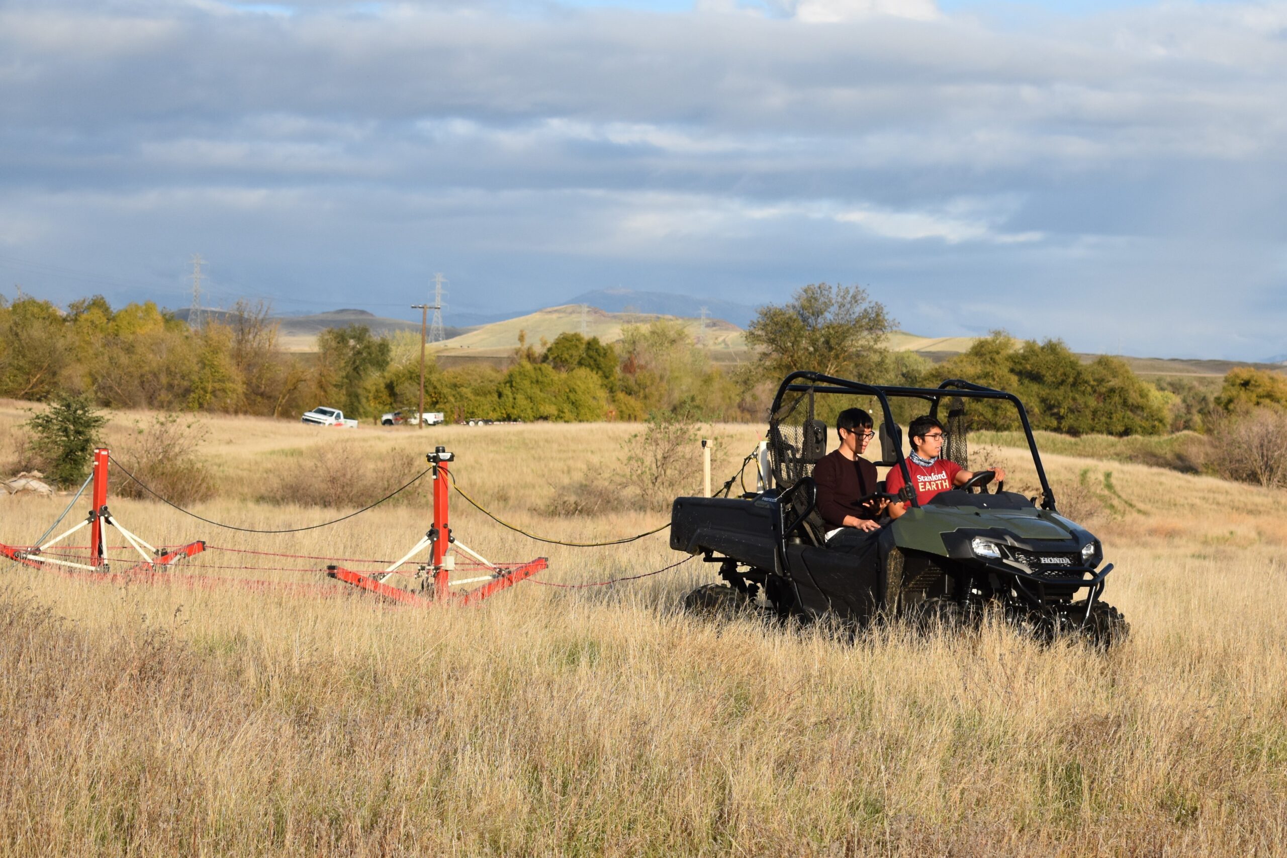
tTEM at Work
Becca Prentice, a third-year Ph.D. candidate at Stanford and part of Dr. Knight’s research lab, has long been interested in using sensors to see what lies underground, especially for environmental benefits.
“Groundwater is such an important resource and we’re so dependent on it, but it’s hard to know how much groundwater is beneath the ground,” said Prentice.
A technology developed in Denmark, tTEM is growing in popularity around the world. One reason is the relative ease in collecting data.
Pulled by an ATV over the area being studied, a transmitter loop generates an electromagnetic field, creating currents below the ground surface. Characteristics of these currents depend on the electrical resistivity of the subsurface materials that are present (e.g. sediments or rocks), and are captured as a signal back to a receiver, which is also being pulled by the ATV. In many cases, the lower the resistivity, the higher the likelihood that there are clays present which act as barriers to the flow of water; higher resistivity is a good indicator of coarse-grained sand and gravel that can result in water flowing more freely in the subsurface.
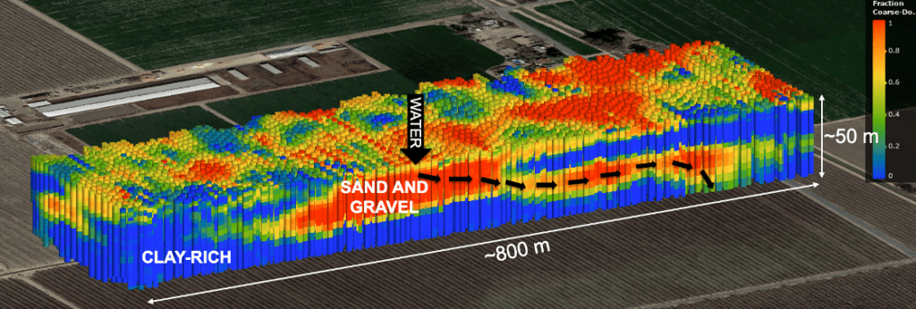
Other ways to investigate groundwater aquifers include drilling wells to directly observe the subsurface materials or measure how surface water infiltrates into the ground. But tTEM is cost-effective and non-invasive, and the resulting imagery, after processing and interpreting with algorithms, can reveal clear pathways for recharge through sediment layers up to nearly 200 feet in depth.
“The images are so amazing and the understanding we can gain of the subsurface at a time when this is needed provides valuable insight we couldn’t get from just all wells,” Prentice said. “tTEM is one of the few ways we can get complete images below the ground to identify these recharge pathways at such detailed scale.”
Meredith Goebel, a research scientist on Dr. Knight’s team, said that when it comes to new research technologies, academics often get a bad rap from those who implement environmental projects.
“They think, ‘Well, you’re doing things that aren’t practical,’ or, ‘no one actually has the time to do that,’” she said. “It’s really fun to help develop tools and techniques that are still novel and exciting from the research perspective. It keeps us interested in our pursuits but seeing them being adopted and seeing them make a difference to decision making is a really rewarding balance between the two.”
Dr. Knight’s team has collected data at River Partners’ Sweetwater, Hidden Valley Ranch, Bear Creek Ranch, Ott Farms, and Grayson restoration sites in the San Joaquin Valley. Gaffney said that what the researchers glean will map out the groundwater storage and recharge potential for the first time ever in River Partners’ 26-year history, guiding and maximizing groundwater recharge returns (and possible infrastructure improvements) for future restoration efforts.
“We can take their findings to help us determine where to place certain planting communities, whether we want to do grading work to maximize groundwater pooling, and how to maximize groundwater recharge potential,” Gaffney said. “It will also help us develop a groundwater conceptual model to better understand how our restoration impacts groundwater recharge on that broader scale, because there’s only so much information you can learn by just looking at that small site and acreage.”
Collaboration and Technology: The Future of Restoration
In groundwater basins across California, time is of the essence. Four groundwater basins in the San Joaquin Valley rank among the world’s most rapidly declining aquifers, according to research published last year. River Partners’ efforts with Stanford and other leading researchers is helping tackle this issue.
“Groundwater depletion is a landscape-sized problem,” said River Partners President Julie Rentner. “We need landscape-scale correction.”
As River Partners continues to revitalize river landscapes and restore floodplains, technologies like tTEM will be increasingly valuable. Goebel envisions tTEM technology advancing with improved resolution and how deep it can capture data and imagery—which would lead to more usage and greater knowledge of groundwater storage potential.
“In five or 10 years, I think it’s highly likely there could be drone-based systems where the transmitter is on the ground and you fly your receiver or you have a really big drone or a mini autonomous helicopter holding both the transmitter and receiver—that’s being tested in Denmark right now,” Goebel said. “Those have exciting potential for places where you couldn’t drive the tTEM system or if it’s flooded.”
Collaborations like the one with Dr. Knight’s team will be just as vital to gain a better understanding of how River Partners fine-tunes our ongoing restoration efforts for maximum returns.
“It’s been exciting to work with people who actually care about their research and who want to help you get the best product possible,” Goebel said. “River Partners have given us the freedom and flexibility saying, ‘You know this best, tell us what you need, and we’ll help you make it happen,’ which in turn motivates us. Both parties are really invested in getting the best product possible.”
“Being in the field and seeing River Partners’ projects, it’s exciting to know that we’re going to have a better understanding of how they help with recharge in the Central Valley,” Prentice said. “It’s inspiring to see these beautiful fields and knowing the potential benefits they have beyond that.”
Doing something that will have a meaningful impact helps make this work so meaningful for Goebel.
“The first time you see the image of what the subsurface looks like, it’s something no one’s ever seen at this site,” she said. “Oftentimes, it’s really complicated, so when you start picking out the patterns and they match up with what you expected to see in the channels or by the river, that first time you see it is the most exciting thing for me.”
This work was funded by generous contributions from the California Wildlife Conservation Board.
Lead photo courtesy of Meredith Goebel


