- Extreme weather events from atmospheric rivers to drought will increase in severity and frequency in the coming decades, a phenomenon known as “weather whiplash.”
- There’s a proven, natural solution that can help protect communities from flooding while also building a more resilient water supply: floodplain restoration.
- River Partners is poised to deliver thousands of acres of restored floodplains in the coming years to boost California’s climate resilience.
For decades, California grappled with its worst recorded droughts, causing widespread water shortages, empty wells, megafires, and species loss.
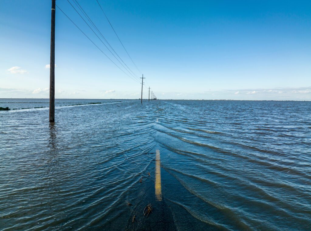
This past winter, however, more than 30 atmospheric rivers unleashed a torrent of water over the state, setting rainfall and snowfall records in many parts of the state. While these storms ended the drought, they unfortunately also left a trail of destruction, breaching levees, claiming lives, and causing an estimated $5-7 billion in damage. The ancient Tulare Lake reemerged in the San Joaquin Valley, flooding an area nearly the size of Lake Tahoe.
Then, this summer, July broke records worldwide as the hottest month ever recorded. Simultaneously, floods devastated towns and cities across the U.S. with record-breaking rainfall. In total, the U.S. endured 15 major weather disasters between January and July, each exceeding $1 billion in losses.
In August, Hurricane Hilary dropped nearly a foot of rain on parts of Southern California, the first hurricane to enter the state in more than a quarter century. Death Valley picked up a year’s worth of rain in a day, and smashed their calendar-day rainfall record.
Climate experts warn these severe events and dramatic swings are a warning sign of what’s to come, urging strategic investments today to protect people and the environment.
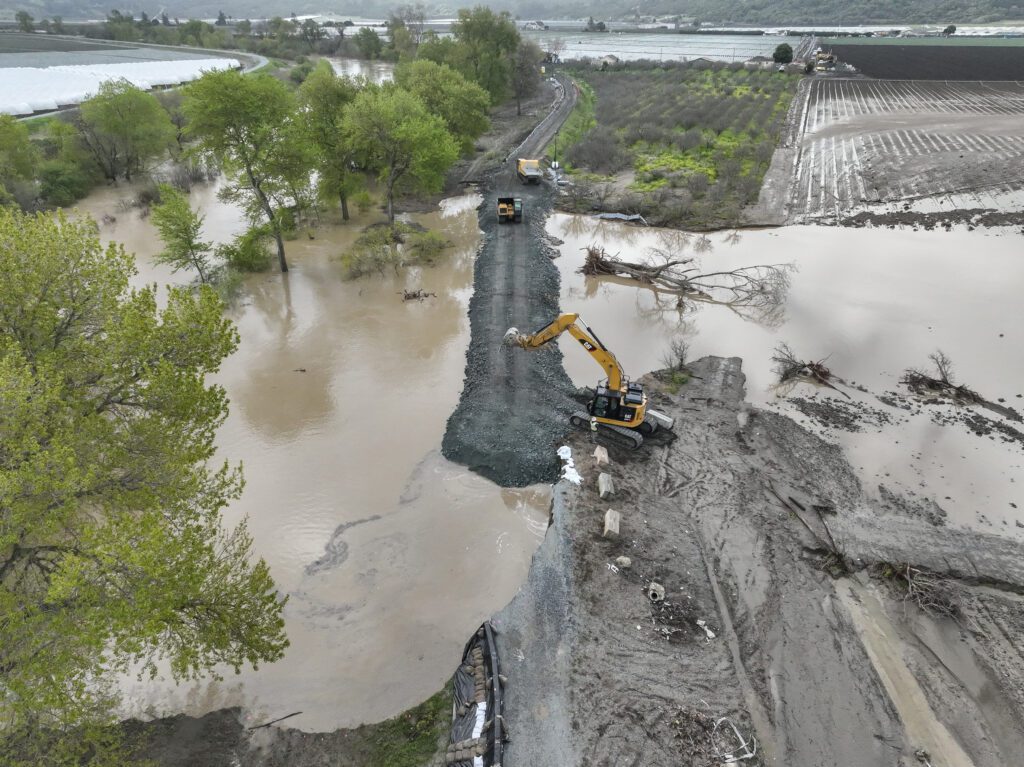
Immediate measures like Governor Newsom’s executive order signed in August to streamline levee repair ahead of what’s predicted to be another wet winter are crucial short-term solutions to keep our communities safe. But, these solutions are costly, and hard-infrastructure is growing increasingly inadequate to endure extreme weather. Ultimately, a long-term strategy is needed to invest in cost-effective, proven natural solutions that will help California adapt to worsening weather extremes.
Restoring river’s natural floodplains is a proven, natural solution that can mitigate the worst impacts of severe weather while also supporting thriving communities and ecosystems.
Reconnecting California’s floodplains can shield us against floods and boost water security in dry years. Expanded river corridors also revive endangered wildlife populations, sequester carbon, and offer shaded heat shelter. Not to mention, proactive measures are exponentially cheaper in the long-term compared to disaster relief and repair.
With unprecedented support from the public and private sectors, River Partners is poised to restore thousands of riverside acres in California’s most imperiled river corridors in the next decade.
A Future of Extremes
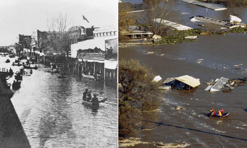
Geologic records and scientific modeling suggest even larger storms will occur, at increasing frequency, which will cause flooding considerably greater than this year’s storms. The ARk2.0 storm model, published in 2022, illustrates the California megastorm scenario, characterized by weeks-long sequences of winter storms that produce wide-spread catastrophic flooding across virtually all of California’s lowlands. When accounting for climate change, the model suggests future flooding could be up to five times greater than previous megastorms.
A megastorm would cause a flooding disaster greater than the Great Flood of 1862, which turned much of the Central Valley into a temporary inland sea. The bulk of the water and damage would fall on the San Joaquin Valley, disproportionately affecting historically disadvantaged communities of color living behind vulnerable levees.
This worst-case scenario event would threaten hundreds of thousands of Californians and cause up to $1 trillion in economic damages, placing it among the costliest natural disasters in global history.
On the flip side, flooding’s painful companion, drought, will also persist for longer and longer periods in between severe precipitation events. Drought and flood will go hand-in-hand, two sides of the same climate coin.
Welcome to the era of weather whiplash, where California must learn to live in between wet and dry extremes. Although, it’s precisely the “in between” weather that’s becoming less and less common with each swing of the climate pendulum. So, in truth, California needs to learn to live in the extremes of drought and deluge.
Luckily, nature has a solution.
Nature’s Shock Absorbers
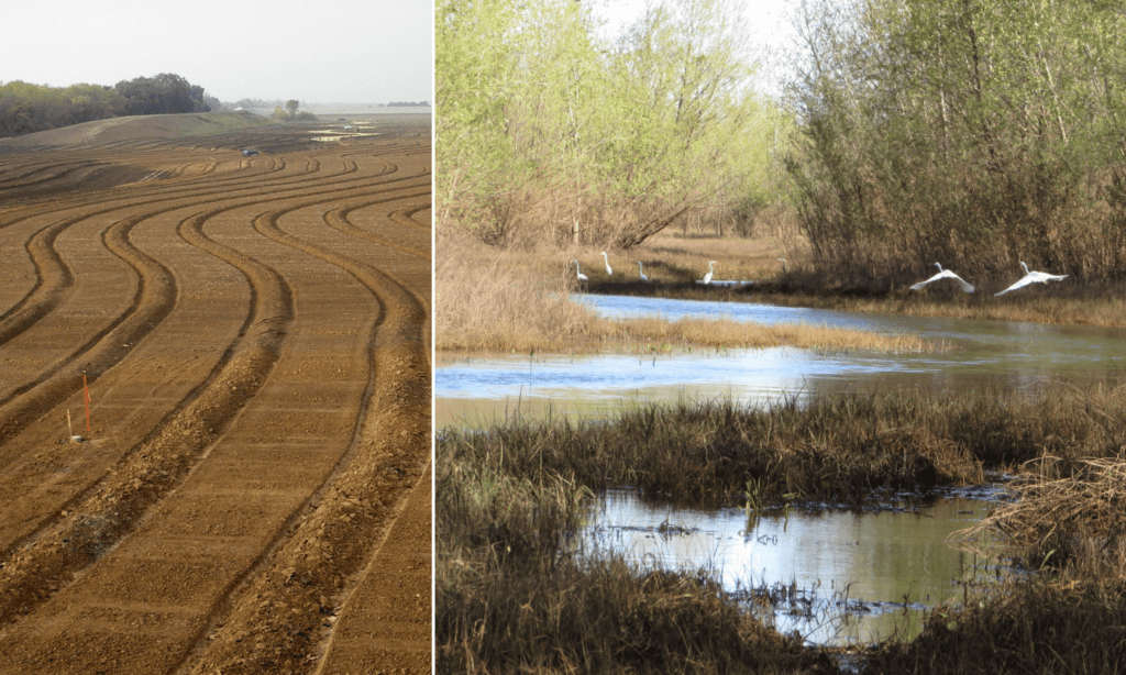
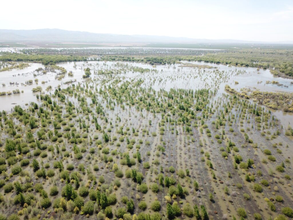
Just like mangrove forests are the first line of defense for communities battered by tropical storms and hurricanes, restored floodplain corridors are nature’s shock absorbers. These expansive riverway landscapes are filled with oak, cottonwood, willow and other naturally drought and flood tolerant plants. Free of constricting levees, they allow swollen rivers to spread out, slow down, and sink in. They possess an incredible ability to mitigate flood risks, store carbon, and foster climate resilience. Restoring rivers and floodplains is not just an environmental endeavor to protect declining biodiversity; it’s a practical solution that holds a key to California’s climate adaptation.
By giving rivers more room, restored floodplains absorb floodwaters and improve flood safety for downstream communities. The excess water doesn’t stagnate; it percolates deep underground, replenishing groundwater resources that are essential for surviving prolonged droughts.
Replacing water-intensive crops with native habitat also conserves freshwater resources. Moreover, these revitalized ecosystems offer refuge to both wildlife and humans, providing havens of cool flowing water and shade from summer heat.
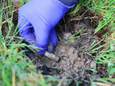
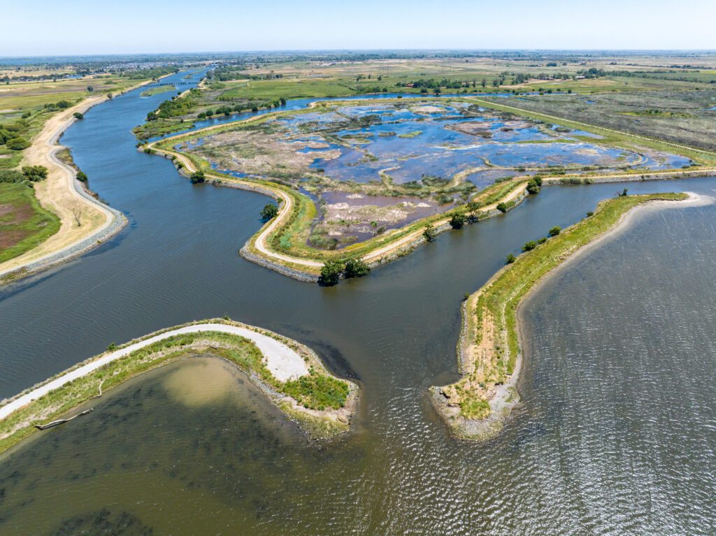
Restoring California’s floodplains is a practical, actionable step River Partners and our network of collaborators are actively implementing across the state—and at a scale that’s never been seen before. This winter, we saw incredible benefits on the nearly 20,000 statewide acres of riverway landscapes we’ve restored over the last 25 years.
Floodplains in Action
This winter, California floodplains sprang into action when rivers swelled and water overtopped levees as water rushed from the Sierra into the Central Valley. At the confluence of the San Joaquin and Tuolumne rivers, floodwaters spread across nearly 11,000 acres of restored floodplains River Partners revitalized. Wildlife thrived, and nearby towns enjoyed the safety buffer.
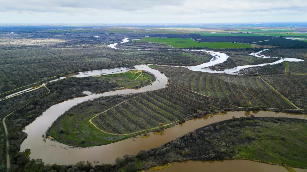
John Mataka is a resident of one such town, Grayson, a small farming community outside Modesto. “I believe the restoration saved our community from some drastic flooding this year,” shared Mataka.
A similar scenario unfolded north of Sacramento, where residents of Hamilton City avoided a major catastrophe thanks to a 6.8-mile levee setback that provides much needed flood protection. In the past 20 years, residents of the town evacuated six times due to flooding. The levee setback, which moves the levee further from the river’s edge, expands a river’s conveyance area and expands riverside habitat. River Partners restored over 1,400 acres of floodplain forest in the setback area.
“Knowing firsthand the kind of financial and emotional burden having your house flood can have, I was uplifted to know that our restoration did what we set out to and gave the townspeople peace of mind,” said River Partners Restoration Ecologist Jade Jacobs.
Working with Nature, Not Against It
Even though flooding can be very destructive, like fire in a forest, floods are a natural river process and essential for ecosystem health. When we fight nature and remove keep water from spreading out across the landscape, storms end up causing more damage in the long term.
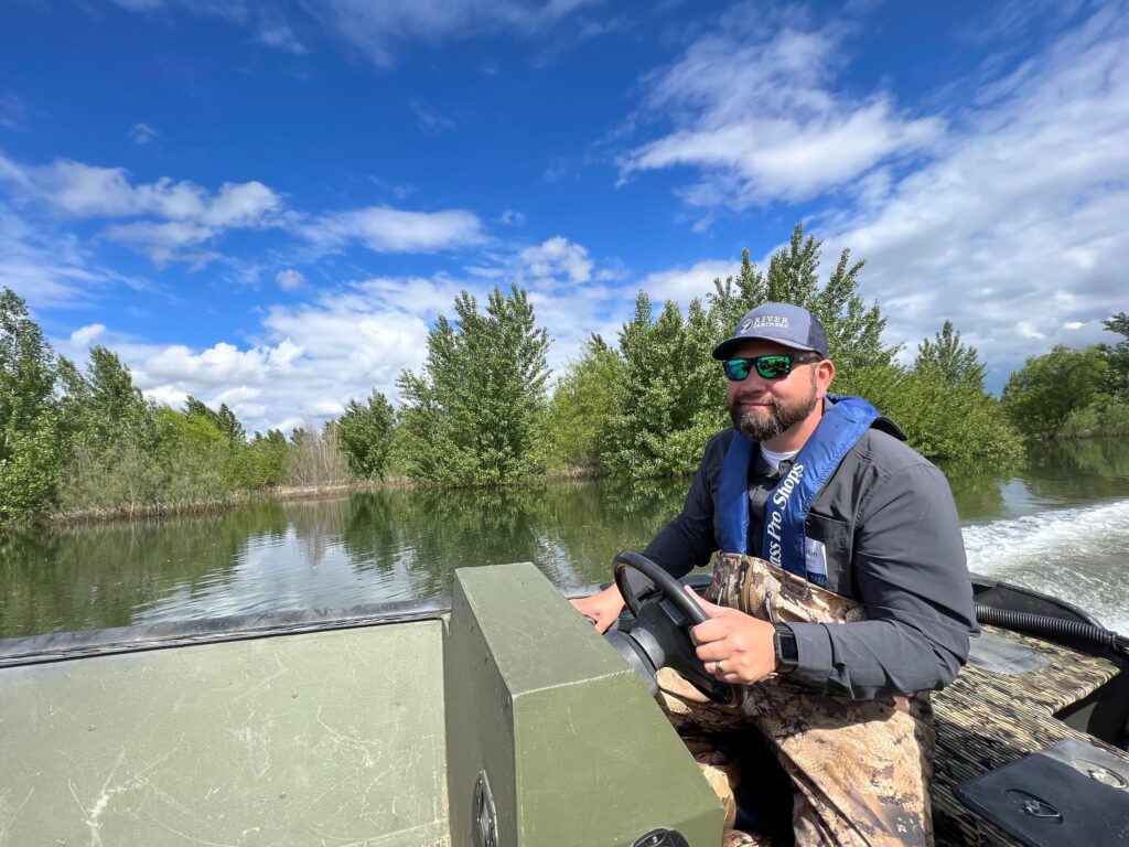
“All that water had a place to go where it was welcomed, rather than in people’s living rooms,” said River Partners Restoration Biologist April Damanti. “Plus, birds and wood ducks had places to congregate, and young salmon found refuge and food in the floodplain.”

River Partners San Joaquin Valley Field Manager Austin Stevenot remarked on how importance of the restored flood cycle. “All of this is a natural floodplain process,” he said. “It’s something the landscape has missed for the last 60-70 years since dams went up. Next to fire, when it happens in the right way, flooding is a great natural process for cleaning up the landscape and creating diverse habitat.”
A New Era for Flood Management in California
For decades, California has relied on engineered solutions as the cornerstone of our flood protection and water supply strategy. In predictable weather, dams and levees safely hold and convey water downstream. However, they are not engineered to stand up to the drought and deluge of intensifying climate-driven weather.
A glaring example of this vulnerability is the Friant-Kern Canal in Tulare County, which has lost a staggering 60% of its water conveyance capacity due to land subsidence in and around the canal caused by the over-pumping of groundwater during drought. When the U.S. Bureau of Reclamation constructed the 150-mile-long canal as part of the Central Valley Project in the 1940s, it was designed to deliver water by gravity from the Friant Dam near Fresno to the Kern River in Bakersfield. No one anticipated the topography would shift so significantly in such a short amount of time, making it physically impossible to deliver the amount of water it was built to transport.
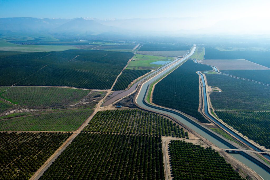
“Drought conditions are hard on our gray infrastructure, which exacerbates the issue even more,” says River Partners President Julie Rentner. “We’ve lost 18 feet due to subsidence since then. The system people rely on for water deliveries can’t deliver as much, so the drought feels even more painful.”
On the flip side, this year’s dramatic winter storms illuminated the poor condition and vulnerability of the state’s thousands of miles of aging, most earthen, levees. We’ve straightjacketed our rivers and reduced their ability to safely convey large surges of water during extreme storms.
“State and federal levees were built right up to the river’s edge, which doesn’t give the water much space to spread out,” says Rentner. “Many levees were engineered poorly, and they haven’t been adequately maintained. In the historic 1997 flood, levees broke in 17 places across the Central Valley. Many levee systems will face challenges—if not failures—in the next big flood.”
Already, the Central Valley Flood Protection Plan, which guides the state’s approach to flood management, recognizes the growing risk. In fact, the plan calls for extensive floodplain restoration and expansion, up to $35 billion in public funding for flood investments over the coming 30 years and $3.2 billion over the next five years. River Partners’ flagship Dos Rios Ranch, the state’s largest public-private floodplain restoration is featured on the plan’s cover.
“There’s no smarter investment that checks all the boxes than floodplains—from flood safety, to groundwater recharge, to public recreation, to wildlife,” says Adam Gray, former California Assemblymember.
California’s commitment to floodplain restoration received a boost this summer when Governor Newsom allocated $40 million for San Joaquin Valley floodplain restoration in the state budget. This investment signifies a collective recognition of the value of floodplains in fortifying the state against climate-driven challenges.
But will it be too late?
“I’m hopeful,” says Rentner. “If small organizations like River Partners can deploy this $40 million immediately for 3,000 acres of floodplain reconnection in the next few years, imagine what we could do if we could align the bulk of the weight of California’s enormous economy toward this problem.”