History, as well as the latest science, tells us major floods are coming, sooner rather than later.
We need to prepare. If we don’t act now, we will swim later.
We haven’t built an ark—though, a physical ark wouldn’t likely be a viable solution to keep California safe. But perhaps metaphorically, we can employ the idea of an ark to help us overcome the mental reflex that floods are a thing of the past, and dams and levees are our only solutions.
In this case, the “ark” is not a wooden vessel, but a different way of thinking. Instead of viewing flood control as a function of costly man-made infrastructure, we can learn to see the power of nature-based solutions.
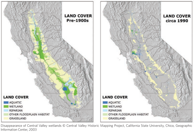
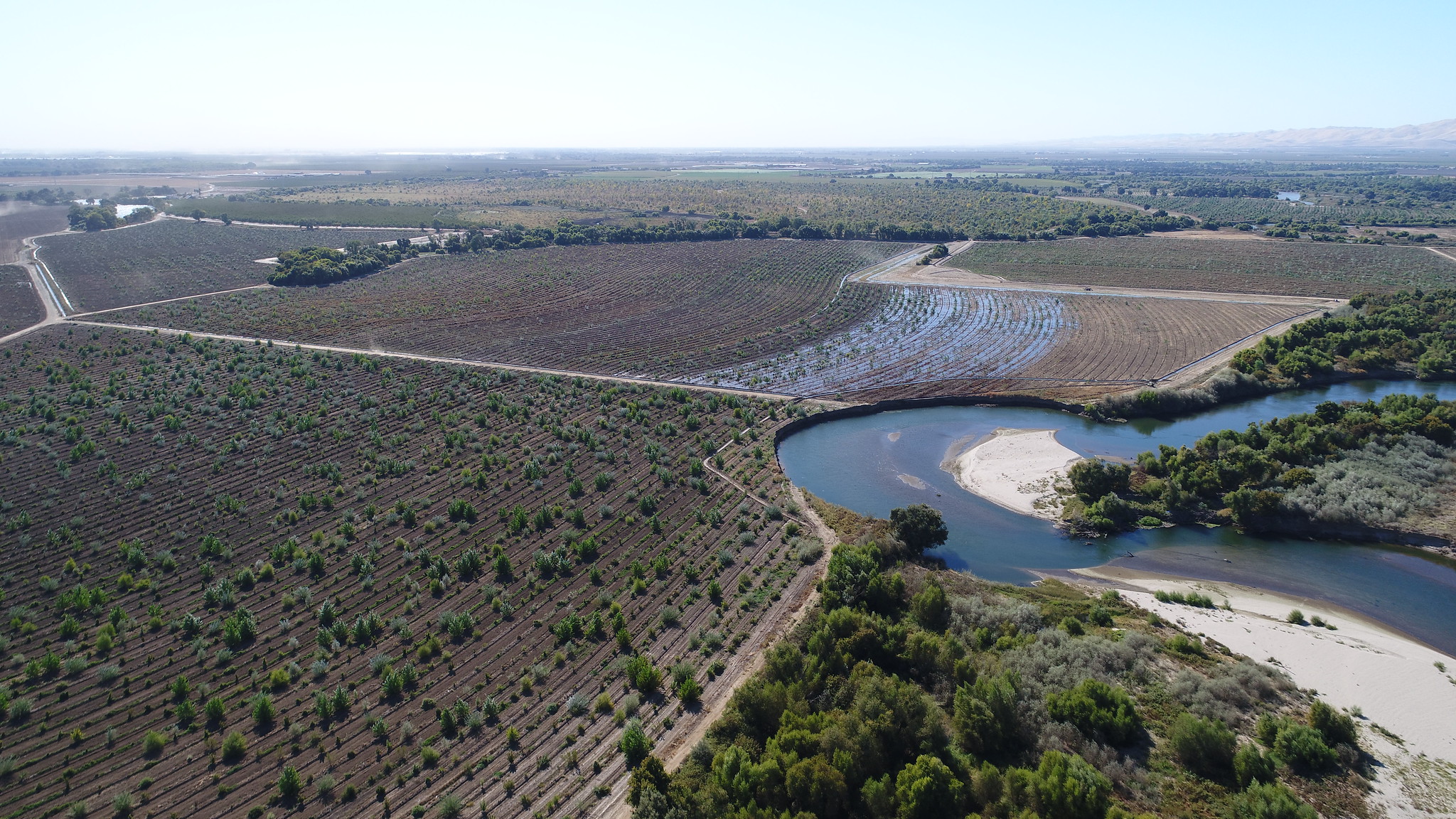
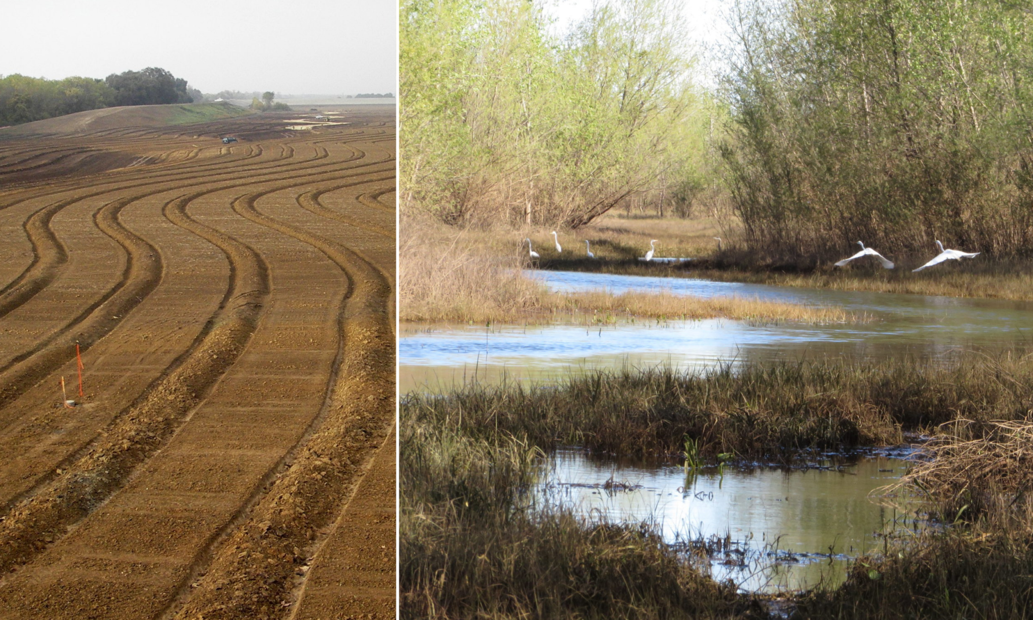
The hydrologic patterns of California’s rivers—wide floodplains and vast wetlands that have all but disappeared, especially in the Central Valley—once provided natural buffers to flooding. Restoring and reconnecting riverside floodplains, and their ability to increase flood safety for communities up and down major rivers, can be the “ark” that gets us through the storms ahead.
This is especially true as experts warn that more precipitation in the state will fall as rain in the future, instead of snow, and the risk of extreme flooding will only grow in the coming decades. These catastrophic floods, predicted to flow with 1.5 to nearly 5 times as much water as previous major floods, will also occur more frequently, about every 5-10 years instead of every 100 years.
Of course, learning to live with natural disasters is nothing new to Californians.
What Forest Fires Can Teach Us about Floods
Those whose job it is to manage California’s timber forests have learned the hard way: you can’t cheat nature.
After nearly 200 years of working against forests’ natural process of burning, firefighters learned that too much fire suppression and not enough fuels management puts communities at greater risk in the long term. Underbrush builds up, fueling wildfires into behemoth megafires and fire tornados that we’re witnessing with increasing frequency. These fires often can’t be stopped, no matter how many millions of dollars’ worth of air tankers we send to drop fire retardants on them.
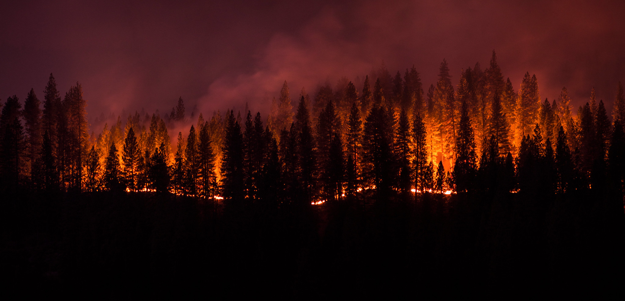
Forest managers have realized forests need to burn to be safe and healthy. The longer we suppress their nature, the more dangerous conditions become. Climate change only fans the flames.
Yet, a parallel challenge is quietly unfolding along California’s rivers and other waterways. Just as we’ve neglected the natural rhythms of fire in forests, we’ve also suppressed rivers’ natural ability to flood.
California has some of the most hydrologically altered waterways on the planet. But, the state’s extensive levee and dam systems can hold only so much water, leaving communities vulnerable when floodwaters are extreme.
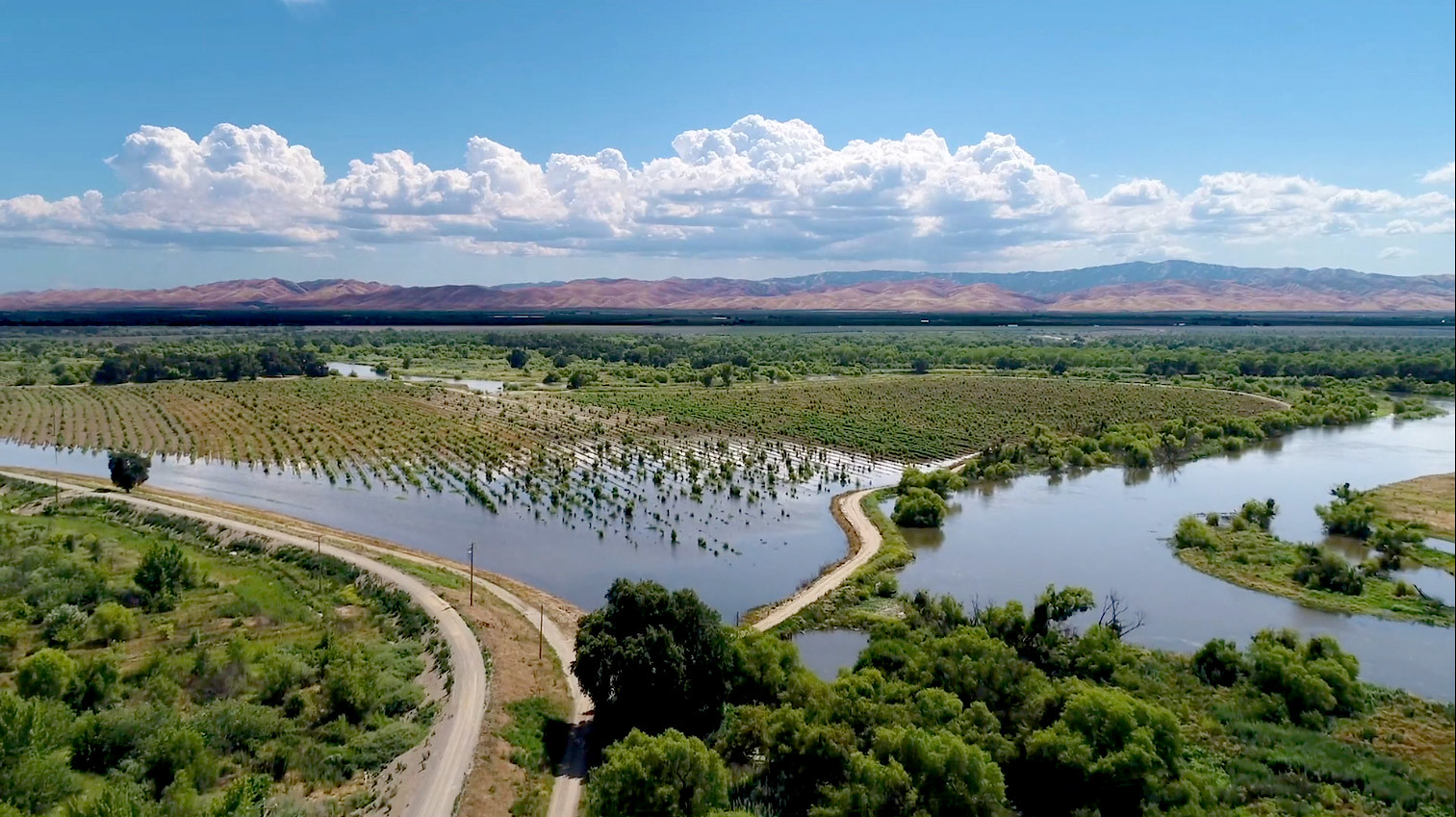
Like fire in a forest, floods are a natural part of our river landscapes and provide essential benefits. Giving rivers room to roam and letting floodwater spread out across the landscape, while seemingly counterintuitive, increases public safety. Healthy rivers can expand naturally, nourishing rich floodplains and wetland habitat that can absorb floodwater. Restored floodplains support native trees and vegetation that sequester carbon, recharge groundwater, and create habitat for imperiled species.
While most people living in California forests and foothills are acutely aware of fire danger, many people living in the Central Valley, where the worst of the future flood impacts are likely to hit, may not be aware of the growing threat.
So, here’s a list of ten things to be aware of when it comes to flooding.
10 Things You Should Know about Flooding in the Central Valley
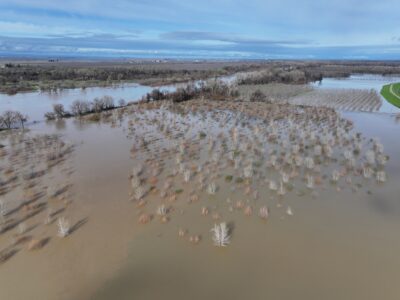
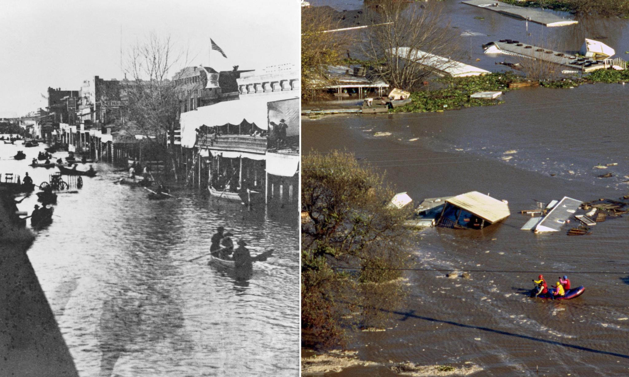
1. Before dams and levees were built in the Central Valley, the Sacramento and San Joaquin rivers didn’t stay put. They carved many paths through the valley and flooded seasonally, at times reaching 30 miles wide. The flooding was so widespread, in fact, that these areas of the Sacramento and San Joaquin valleys were often referred to “inland seas.”
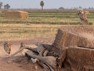
2. The rivers flooded vast wetlands and marshy areas of nearly four million acres (an area four times the size of Rhode Island) that supported some of the most abundant wildlife on the planet, filled with animals such as migratory birds, tule elk, and salmon. Native Californians understood the flood cycles and migrated seasonally with food sources and away from floodwaters.
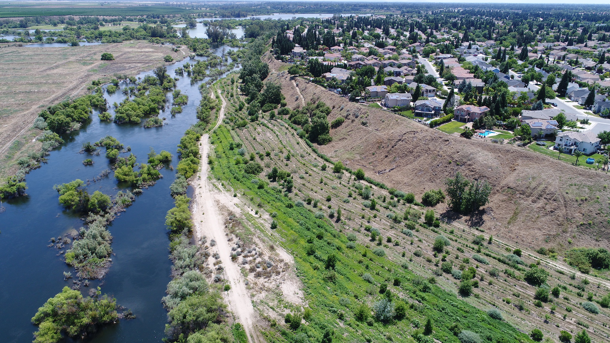
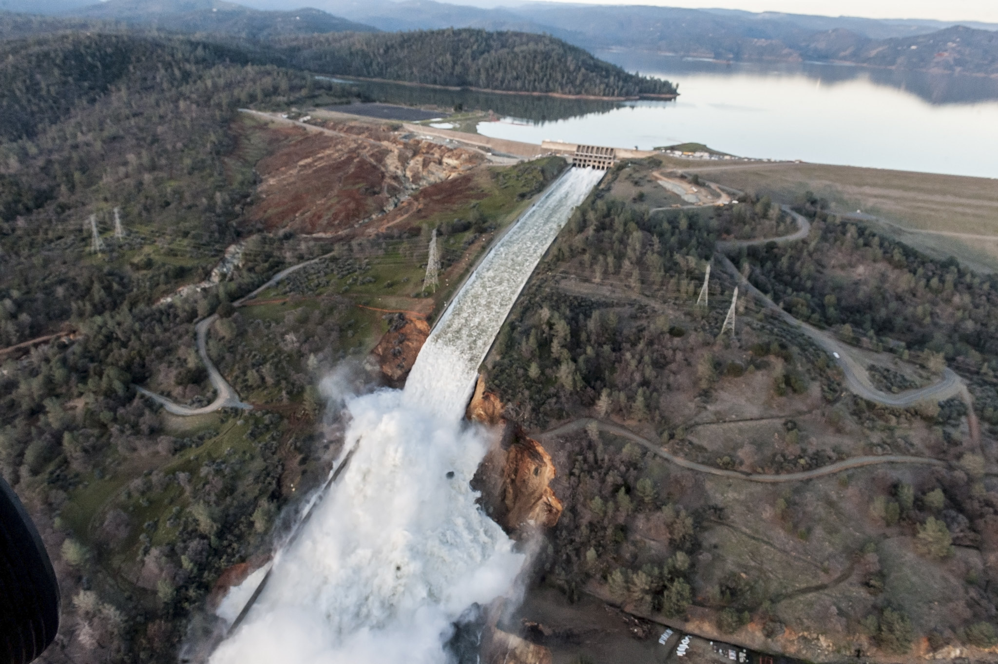
3. Today, many people live in places where it used to flood regularly, such as Stockton and Sacramento. The safety of these communities is dependent on flood control infrastructure, including a network of 23 reservoirs; major dams such as Shasta Dam, Oroville Dam, and Folsom Dam; and more than 1,760 miles of federally designated levees, overflow weirs, and channels. Millions of people live and work in the floodplains of the valley.
4. Geologic evidence and traditional knowledge of the valley indicate that massive floods occur in California every 100-200 years. This includes The Great California Flood of 1861-1862, which inundated Sacramento with water 20 feet deep in certain places. The 1997 flood also falls into this category. It broke records of what we expected from 100-year floods, causing an estimated $2 billion dollars in damage, and killing nine people.
5. Severe floods are not a thing of the past, but a likely future reality. In 2017, analysis of climate change’s impact on flood risk projected that major flooding along the San Joaquin River would increase by 80%—a significant increase. Yet, the most recent analysis from 2022 washes that prediction away and anticipates the severity of 100-year flood events will increase by 1.5 to nearly 5 times by 2070. Let that sink in (pun intended). We’re predicted to see flood flows 150% to 500% larger than what was considered catastrophic in 1997.
6. Floods are not only predicted to get more severe, but also more frequent. Typically, 100-year events have a 1% chance of occurring in any given year and a 26% chance of occurring over a 30-year period—the typical span of a home mortgage. That’s changing with new climate projections. Catastrophic floods will occur more frequently, about every 5-10 years instead of every 100 years.
7. Climate change is a major factor. Despite more intense and frequent flooding, experts predict deepening and truly historic periods of drought for California. However, dry times will be punctuated with atmospheric rivers that dump huge quantities of water. Warmer storms will bring rains to the slopes of the Sierra instead of snowfall, which run off rapidly, creating massive flows of water in short periods of time. Normally, snow melts slowly and feeds creeks and rivers throughout spring and summer. Flooding has wide implications for farms which depend on a slow release of water during dry months.
8. The San Joaquin Valley holds higher risk than the Sacramento Valley. The median elevation of the Sierra Nevada mountain range above the San Joaquin Valley is 7,000 feet, much higher than the mountains that run off into the Sacramento Valley. When large, warm storms hit mountains, areas with the highest elevation will capture the most rain and runoff. Cities such as Stockton and Modesto, as well as rural agricultural communities throughout the San Joaquin Valley will be the hardest hit—experts expect the damages from increased flooding will be over $2 billion, annually. The damage caused by the most severe floods would be dramatically higher. Many of the communities most at risk are economically disadvantaged, working-class communities of color that have not received equitable funding and resources for flood protection in the past.
9. Reinforcing existing levees alone would fail to protect communities from growing flood risks. Flood planners, scientists, city leaders, and other stakeholders agree that we need nature-based solutions to meet the threat to vulnerable communities by expanding and restoring floodplains.
10. We can protect areas where the consequences of flooding are the greatest by expanding and restoring floodplains. Giving rivers more room is the best and cheapest way to protect not only human communities, but also natural communities, from the big floods that climate change are going to bring.
Our Future Depends on the Action We Take Today
The prognosis isn’t great, but luckily, we have time to act. Infrastructure like levees are necessary to protect communities, but we also need to expand floodplains and flood bypass capacity. According to the California Department of Water Resources, just doing these two things will reduce expected annual flood damage along the San Joaquin River by 80-90%.
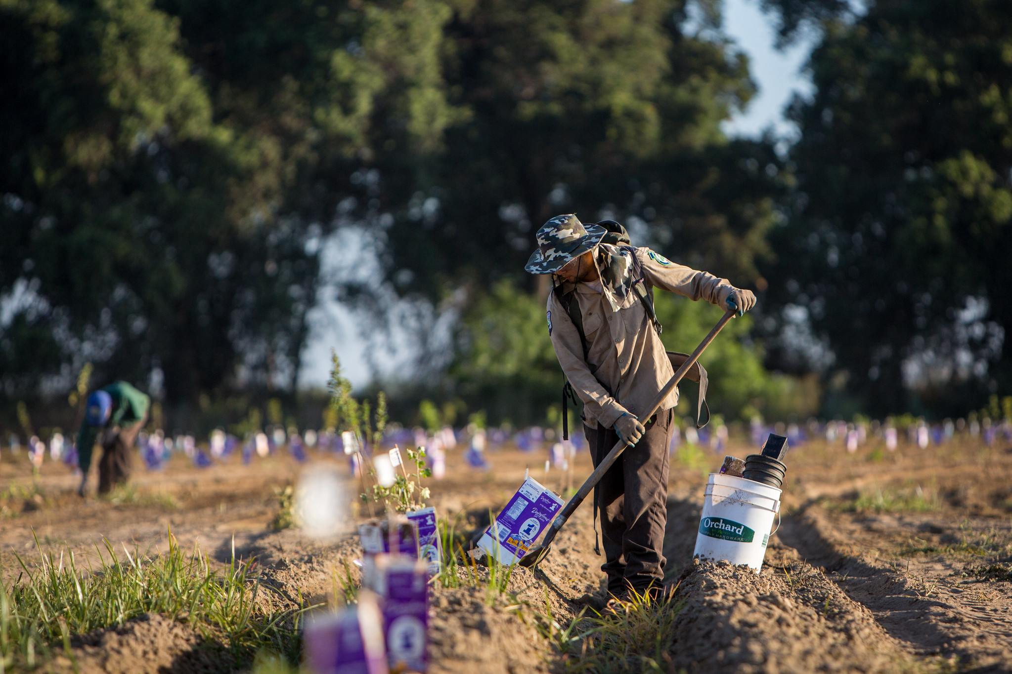
River Partners has restored riverways throughout the state to mitigate the effects of flooding, including completing the largest floodplain restoration project in California’s history. But, restoring floodplains doesn’t just prioritize public safety—it increases groundwater recharge for the dry years ahead and improves water quality because healthy rivers filter sediment and runoff. Fish and wildlife benefit from expanded habitat, in addition to people, who have improved access to open space along riverways. Restored riparian forests also sequester carbon at a faster rate than timber forests due to their rapid growth rate—pulling carbon from the air and putting it back where we want it, in the soil. Reviving floodplains also creates good green jobs and strengthens local economies.
The Central Valley is not underwater right now. We need California lawmakers to prioritize public safety and fund more floodplain restoration so we can prepare our most vulnerable communities for what’s ahead.
Together, let’s build that ark.